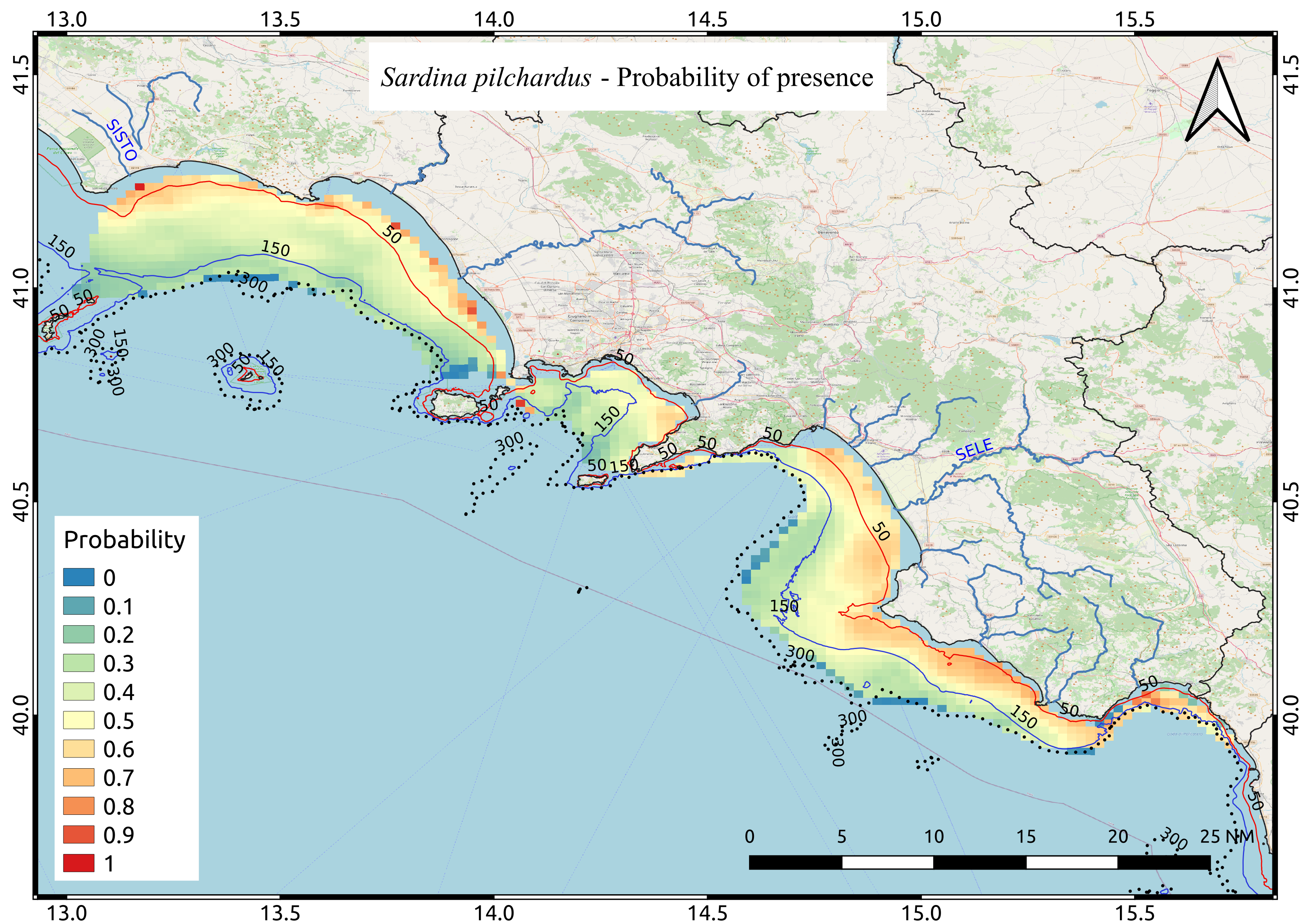
Sardina pilchardus probability of presence
Mappa media di probabilità di presenza relativa alla specie Sardina pilchardus calcolata, attraverso l'utilizzo di un approccio geostatistico (Indicator Kriging), sulla base di 9 anni di campagne di valutazione acustica della biomassa ittica pelagica svolte nel periodo estivo
Simple
- Date ( Creation )
- 2020-11-20
- Credit
- CNR-ISMAR; CNR-IAS
- Status
- On going
- Maintenance and update frequency
- Not planned
- Keywords
-
- feamp
- campania
- Sardina pilchardus
- Probability map
- GEMET - INSPIRE themes, version 1.0 GEMET - INSPIRE themes, version 1.0 ( Theme )
-
- Species distribution
- Use limitation
- None
- Use constraints
- Other restrictions
- Other constraints
- Data policy of the project (link)
- Access constraints
- Other restrictions
- Other constraints
- Data policy of the project (link)
- Classification
- Unclassified
- Spatial representation type
- Grid
- Metadata language
- it
- Character set
- UTF8
- Topic category
-
- Biota
N
S
E
W
))
- Supplemental Information
- Any other descriptive information about the dataset
- Reference system identifier
- EPSG:32633
Spatial representation info
No information provided.
- Number of dimensions
- 3
- Cell geometry
- Area
- Distribution format
-
-
geoTIFF
(
e. g.. v1.0
)
-
geoTIFF
(
e. g.. v1.0
)
- OnLine resource
-
PIL
(
WWW:LINK-1.0-http--link
)
Average probability map of Sardina pilchardus computed by means of Indicator kriging based on 9 years of acoustic surveys carried out in the summer period
- Hierarchy level
- Dataset
- Other
- Cella 1 miglio nautico quadrato
Conformance result
- Date ( Revision )
- 2020-08-04
- Explanation
- Validated in Geonetwork according to the ISO19115 rules (23/23) and the INSPIRE rules (29/29)
- Pass
- Yes
- Statement
- Marco Barra (CNR-ISMAR) processed data collected during 9 acoustic surveys (2009, 2011 and 2013 - 2019 ) carried out in the summer period. Indicator maps were computed using Indicator Kriging.
- File identifier
- 12139d3c-0eac-4b1f-8591-d978fbc05fec XML
- Metadata language
- en
- Character set
- UTF8
- Hierarchy level
- Dataset
- Date stamp
- 2020-11-20T16:09:00
- Metadata standard name
- ISO 19115:2003/19139
- Metadata standard version
- 1.0
Overviews

Spatial extent
N
S
E
W
))
Provided by

Associated resources
Not available
 FEAMP GeoNetwork catalogue