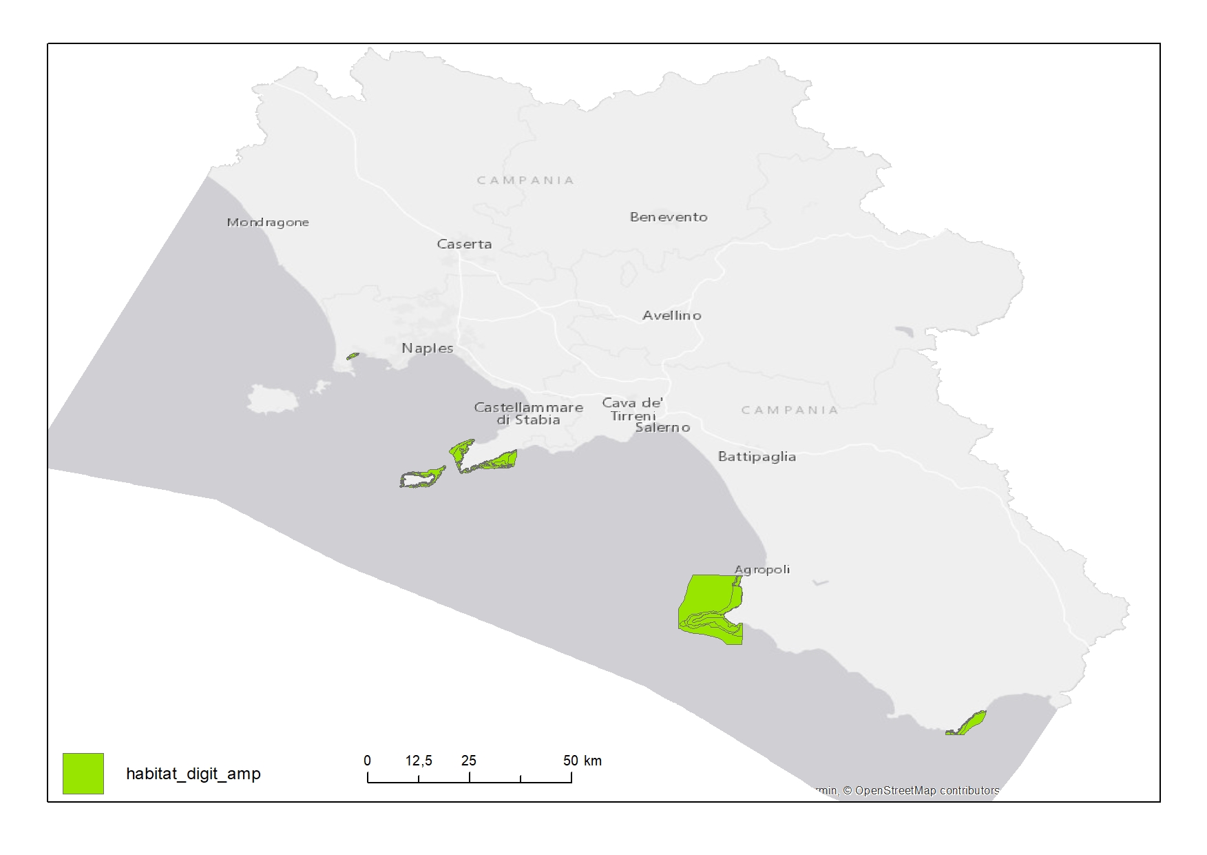
Habitat map of Marine Protected Area
Habitat map of Marine Protected Areas (MPAs) in Campania Region
Simple
- Date ( Creation )
- 2020-07-16
- Credit
- © Università degli Studi di Napoli “Parthenope”
- Status
- Completed
- Maintenance and update frequency
- As needed
- Keywords
-
- feamp
- campania
- habitat
- extent
- chart
- map
- marine protected area
- GEMET - INSPIRE themes, version 1.0 GEMET - INSPIRE themes, version 1.0 ( Theme )
-
- Habitats and biotopes
- Use limitation
- None
- Use constraints
- Other restrictions
- Other constraints
- Data policy of the project
- Access constraints
- Other restrictions
- Other constraints
- Data policy of the project
- Classification
- Unclassified
- Spatial representation type
- Vector
- Metadata language
- it
- Character set
- UTF8
- Topic category
-
- Biota
N
S
E
W
))
- Supplemental Information
- None
- Reference system identifier
- WGS 1984 - UTM 33N
Spatial representation info
No information provided.
- Topology level
- Geometry only
- Geometric object type
- Surface
- Geometric object count
- 292
- Distribution format
-
-
Shapefile
(
.shp
)
-
Shapefile
(
.shp
)
- Hierarchy level
- Dataset
- Other
- Poligoni
Conformance result
- Date ( Revision )
- 2020-08-04
- Explanation
- Validated in Geonetwork according to the ISO19115 rules (26/26) and the INSPIRE rules (29/29)
- Pass
- Yes
- Statement
- Luca Lisciani (CNR-ISMAR) digitized the polygons from digital maps in the paper: https://www.researchgate.net/publication/267693659_Gli_habitat_sottomarini_delle_coste_della_Campania
- File identifier
- 31d7f397-bb68-4dea-acd4-1165c023d4c6 XML
- Metadata language
- en
- Character set
- UTF8
- Hierarchy level
- Dataset
- Date stamp
- 2020-08-21T10:14:48
- Metadata standard name
- ISO 19115:2003/19139
- Metadata standard version
- 1.0
Overviews

Spatial extent
N
S
E
W
))
Provided by

Associated resources
Not available
 FEAMP GeoNetwork catalogue