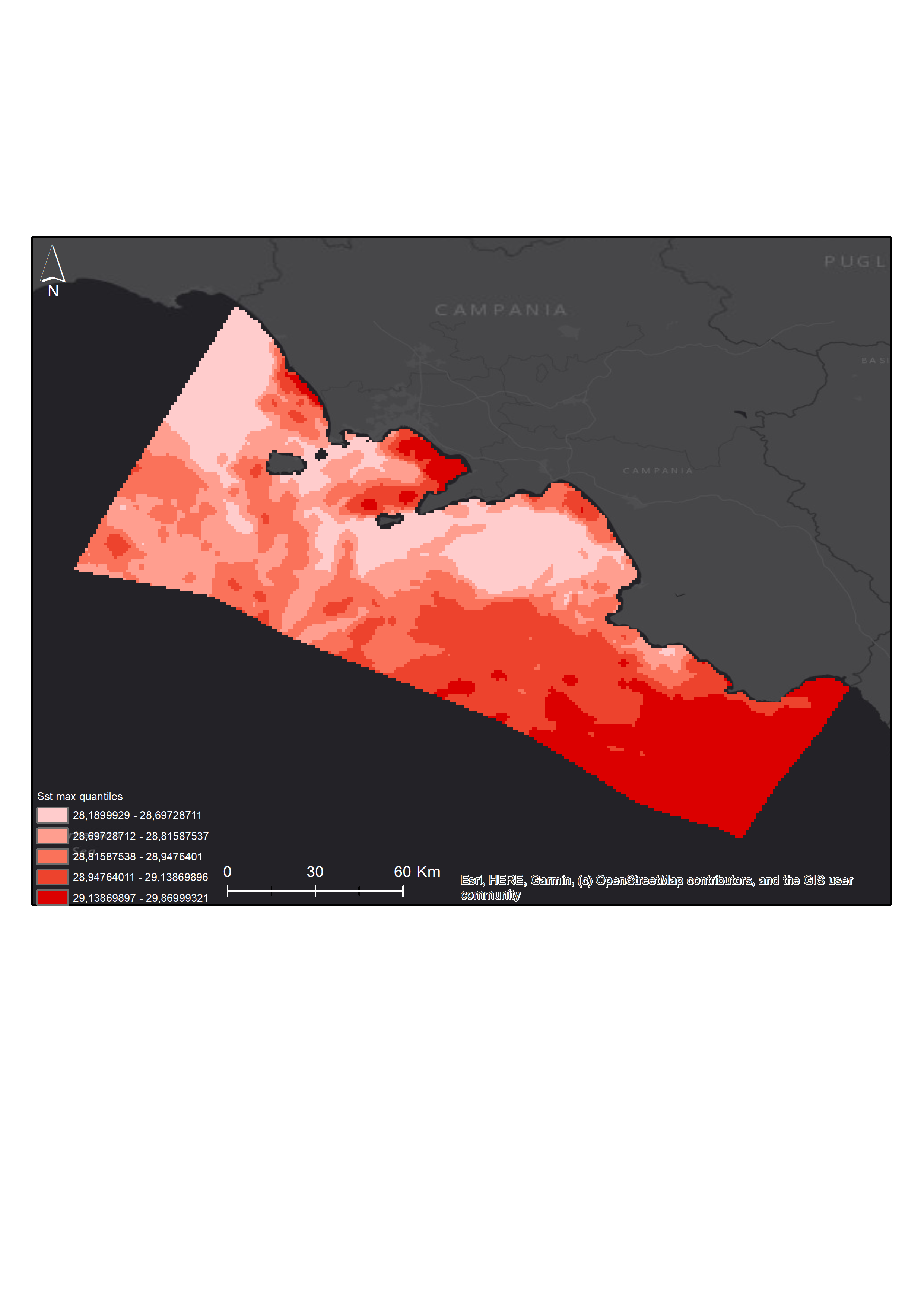
Mean, maximum and minimum sea surface temperature maps of 2020
The superficial sea temperature (SST) map package was built with daily-mean data remotely collected. The package contains mean, max, min SST maps at high resolution (~1km) collected during 2020. The maps were also built over the four quarters of the year. These layers are provided with the suffixes Q1 to Q4.
Simple
- Date ( Creation )
- 2020-11-11
- Credit
- SZN
- Status
- Completed
- Maintenance and update frequency
- As needed
- Keywords
-
- feamp
- campania
- temperature
- GEMET - INSPIRE themes, version 1.0 GEMET - INSPIRE themes, version 1.0 ( Theme )
-
- Hydrography
- Use limitation
- None
- Use constraints
- Other restrictions
- Other constraints
- Data policy of the project (link)
- Access constraints
- Other restrictions
- Other constraints
- Data policy of the project (link)
- Classification
- Unclassified
- Spatial representation type
- Grid
- Distance
- 0.01 degree
- Metadata language
- it
- Character set
- UTF8
- Topic category
-
- Oceans
N
S
E
W
))
- Reference system identifier
- WGS 1984 (EPSG 4326)
Spatial representation info
No information provided.
- Number of dimensions
- 3
- Cell geometry
- Area
- Distribution format
-
-
GeoTiff
(
.tif
)
-
GeoTiff
(
.tif
)
- OnLine resource
- https://geonode.bioinfo.szn.it/s/9TC9TrPFrpxTZxZ ( WWW:LINK-1.0-http--link )
- Hierarchy level
- Dataset
- Other
- raster
Conformance result
- Date ( Revision )
- 2020-08-04
- Explanation
- Validated in Geonetwork according to the ISO19115 rules (23/23) and the INSPIRE rules (29/29)
- Pass
- Yes
- Statement
- The rasters were built in R statistical software using public available data downloaded from Copernicus Marine Environment Monitoring Service (https://resources.marine.copernicus.eu/?option=com_csw&task=results). The netCDF files were converted into 3-dimensional arrays (longitude, latitude and time) and reanalyzed in order to extract the mean/max/min value of each pixel over the year and over a specific quarter of the year.
- File identifier
- 4d976fb1-2854-4258-a099-0eccc340ad4d XML
- Metadata language
- en
- Character set
- UTF8
- Hierarchy level
- Dataset
- Date stamp
- 2021-05-14T08:57:58
- Metadata standard name
- ISO 19115:2003/19139
- Metadata standard version
- 1.0
Overviews


Spatial extent
N
S
E
W
))
Provided by

Associated resources
Not available
 FEAMP GeoNetwork catalogue