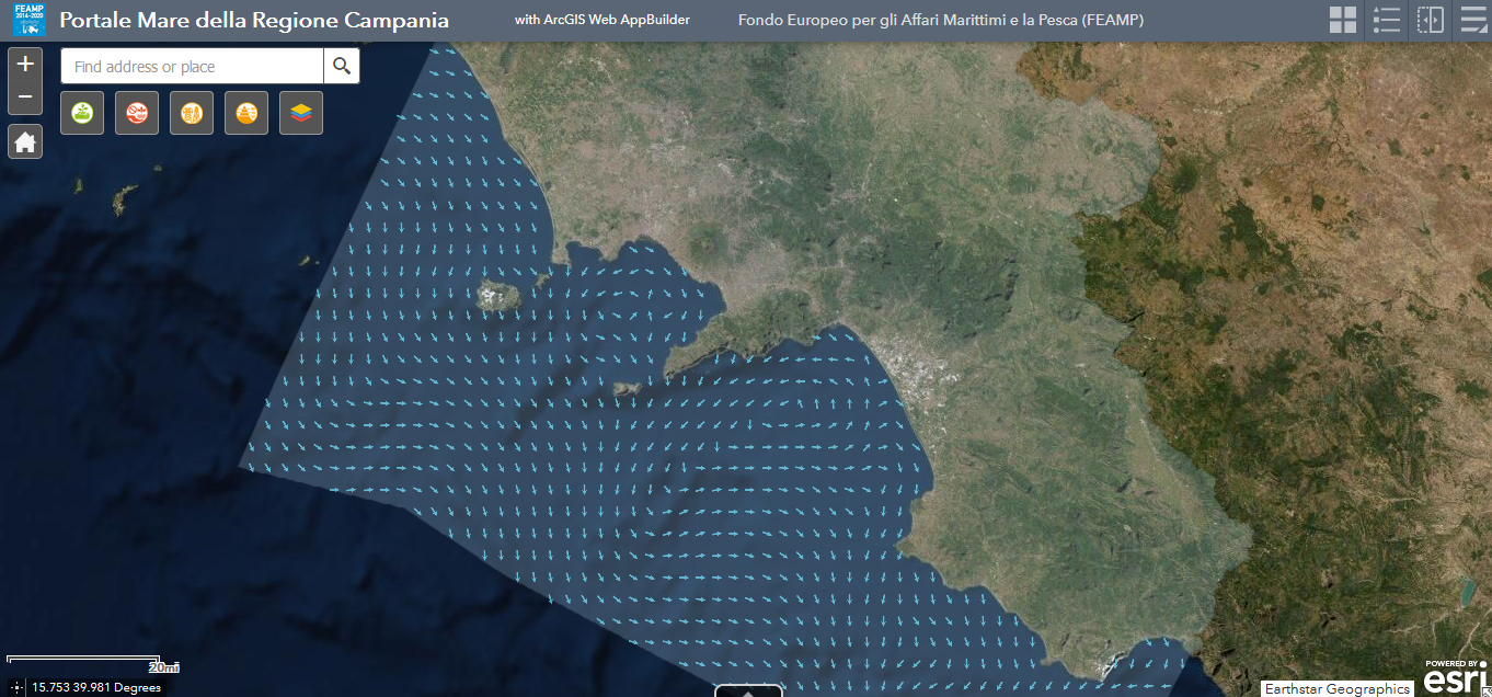
Current Surface Direction/Speed February 2021 - Elaborazione Dati Copernicus
The physical component of the Mediterranean Forecasting System (Med-Currents) is a coupled hydrodynamic-wave model implemented over the whole Mediterranean Basin including tides. The model horizontal grid resolution is 1/24˚ (ca. 4 km) and has 141 unevenly spaced vertical levels.The hydrodynamics are supplied by the Nucleous for European Modelling of the Ocean (NEMO v3.6) while the wave component is provided by Wave Watch-III; the model solutions are corrected by a variational data assimilation scheme (3DVAR) of temperature and salinity vertical profiles and along track satellite Sea Level Anomaly observations.
Product Citation:
Please refer to our Technical FAQ for citing products.http://marine.copernicus.eu/faq/cite-cmems-products-cmems-credit/?idpage=169
REFERENCES
https://doi.org/10.25423/CMCC/MEDSEA_ANALYSISFORECAST_PHY_006_013_EAS6
Clementi, E., Aydogdu, A., Goglio, A. C., Pistoia, J., Escudier, R., Drudi, M., Grandi, A., Mariani, A., Lyubartsev, V., Lecci, R., Cretí, S., Coppini, G., Masina, S., & Pinardi, N. (2021). Mediterranean Sea Physical Analysis and Forecast (CMEMS MED-Currents, EAS6 system) (Version 1) [Data set]. Copernicus Monitoring Environment Marine Service (CMEMS).
Further details: https://resources.marine.copernicus.eu/?option=com_csw&view=details&product_id=MEDSEA_ANALYSISFORECAST_PHY_006_013
Simple
- Date ( Creation )
- 2021-07-09
- Credit
- Stazione Zoologica Anton Dohrn
- Status
- Completed
- Maintenance and update frequency
- As needed
- Keywords
-
- feamp
- campania
- Direction current surface
- GEMET - INSPIRE themes, version 1.0 GEMET - INSPIRE themes, version 1.0 ( Theme )
-
- Oceanographic geographical features
- Atmospheric conditions
- Meteorological geographical features
- Use limitation
- None
- Use constraints
- Other restrictions
- Other constraints
- Data policy of the project (link)
- Access constraints
- Other restrictions
- Other constraints
- Data policy of the project (link)
- Classification
- Unclassified
- Spatial representation type
- Vector
- Metadata language
- it
- Character set
- UTF8
- Topic category
-
- Climatology, meteorology, atmosphere
- Environment
- Geoscientific information
))
- Supplemental Information
- Any other descriptive information about the dataset
- Reference system identifier
- Coordinate system (e.g. WGS 1984)
Spatial representation info
- Number of dimensions
- 3
- Cell geometry
- Area
- Distribution format
-
-
Format of the resource (e.g. *.shp)
(
e. g.. v1.0
)
-
Format of the resource (e.g. *.shp)
(
e. g.. v1.0
)
- OnLine resource
- Luciano Bosso Direzioni Correnti Superficiali (medie) da gennaio2020 a maggio2021 ( WWW:LINK-1.0-http--link )
- Hierarchy level
- Model
- Other
- x
Conformance result
- Date ( Revision )
- 2020-08-04
- Explanation
- Validated in Geonetwork according to the ISO19115 rules (23/23) and the INSPIRE rules (29/29)
- Pass
- Yes
- Statement
- Luciano Bosso (SZN) uploaded the polygons provided by CMES
- File identifier
- 770c3b0f-5eed-48de-8178-3446bd160897 XML
- Metadata language
- en
- Character set
- UTF8
- Hierarchy level
- Dataset
- Date stamp
- 2021-07-12T10:04:04
- Metadata standard name
- ISO 19115:2003/19139
- Metadata standard version
- 1.0
Overviews

Spatial extent
))
Provided by

 FEAMP GeoNetwork catalogue