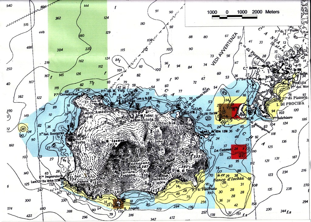
Mappa of Area Marina Protetta Regno di Nettuno
Map showing the position and the zoning of the protected site "Area Marina Protetta Regno di Nettuno" in the Campania region
Simple
- Date ( Creation )
- 2019-09-16
- Presentation form
- Digital map
- Credit
- ©
- Status
- On going
- Maintenance and update frequency
- As needed
- Keywords
-
- feamp
- campania
- chart
- protection
- conservation
- mpa
- marine protected area
- GEMET - INSPIRE themes, version 1.0 GEMET - INSPIRE themes, version 1.0 ( Theme )
-
- Protected sites
- Use limitation
- none
- Access constraints
- Other restrictions
- Other constraints
- Data policy of the project (link)
Resource constraints
No information provided.
- Use constraints
- Other restrictions
- Other constraints
- Data policy of the project (link)
- Classification
- Restricted
- Metadata language
- it
- Topic category
-
- Environment
- Description
- x
N
S
E
W
))
- Supplemental Information
- For further information go to link: https://www.minambiente.it/pagina/area-marina-protetta-regno-di-nettuno
- Distribution format
-
-
PDF
(
.pdf
)
-
PDF
(
.pdf
)
- Hierarchy level
- Non geographic dataset
- Other
- Carta
Conformance result
- Date ( Revision )
- 2020-08-20
- Explanation
- Validated in Geonetwork according to the ISO19115 rules (24/24) and the INSPIRE rules (30/30)
- Pass
- Yes
- Statement
- Francesco Andaloro provided the chart on 16/09/2019 in the framework of the project
- File identifier
- 7a8415c9-b287-4172-b7da-e901afdc7ed2 XML
- Metadata language
- en
- Character set
- UTF8
- Hierarchy level
- Dataset
- Date stamp
- 2020-08-21T09:04:18
- Metadata standard name
- ISO 19115:2003/19139
- Metadata standard version
- 1.0
Overviews

Spatial extent
N
S
E
W
))
Provided by

Associated resources
Not available
 FEAMP GeoNetwork catalogue