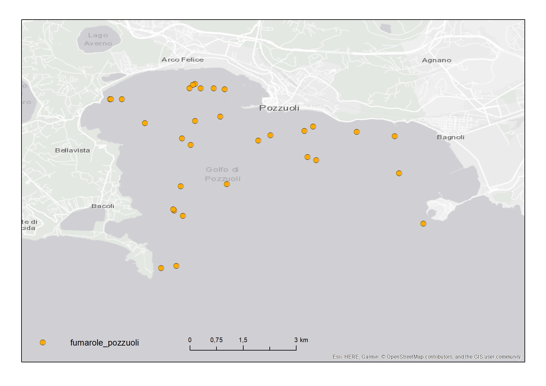
Active fluid vents - Gulf of Pozzuoli
Active fluid vents in the Gulf of Pozzuoli (Campania Region) represented in "Carta della morfologia del fondale della Baia di Pozzuoli, Golfo di Napoli"
Simple
- Date ( Creation )
- 2020-07-30
- Credit
- © INGV, CNR
- Status
- On going
- Maintenance and update frequency
- As needed
- Keywords
-
- feamp
- campania
- chart
- hydrothermal vent
- pozzuoli
- GEMET - INSPIRE themes, version 1.0 GEMET - INSPIRE themes, version 1.0 ( Theme )
-
- Geology
- Use limitation
- None
- Use constraints
- Other restrictions
- Other constraints
- Data policy of the project
- Access constraints
- Other restrictions
- Other constraints
- Data policy of the project
- Classification
- Restricted
- Spatial representation type
- Vector
- Metadata language
- it
- Character set
- UTF8
- Topic category
-
- Geoscientific information
N
S
E
W
))
- Supplemental Information
- https://doi.org/10.1080/17445647.2014.1001800
- Reference system identifier
- WGS 84
Spatial representation info
No information provided.
- Topology level
- Geometry only
- Geometric object type
- Point
- Geometric object count
- 31
- Geometric object type
- Point
- Geometric object count
- 33
- Distribution format
-
-
Shapefile
(
.shp
)
-
Shapefile
(
.shp
)
- Hierarchy level
- Dataset
- Other
- Punti
Conformance result
- Date ( Revision )
- 2020-08-20
- Explanation
- Validated in Geonetwork according to the ISO19115 rules (26/26) and the INSPIRE rules (29/29)
- Pass
- Yes
- Statement
- Enzo Saggiomo provided the coordinates of the fluid vents in the framework of the project on 30/07/2020 as .xlsx file. Then the CNR-ISMAR digitized them as a punctual shapefile.
- File identifier
- e5d9ff87-751f-4445-a7c5-af0c6ec7dcaf XML
- Metadata language
- en
- Character set
- UTF8
- Parent identifier
- Carta della morfologia del fondale della Baia di Pozzuoli, Golfo di Napoli 4083c4a2-573d-425b-b3db-ba374a249ee8
- Hierarchy level
- Dataset
- Date stamp
- 2020-12-16T14:32:18
- Metadata standard name
- ISO 19115:2003/19139
- Metadata standard version
- 1.0
Overviews

Spatial extent
N
S
E
W
))
Provided by

Associated resources
Not available
 FEAMP GeoNetwork catalogue