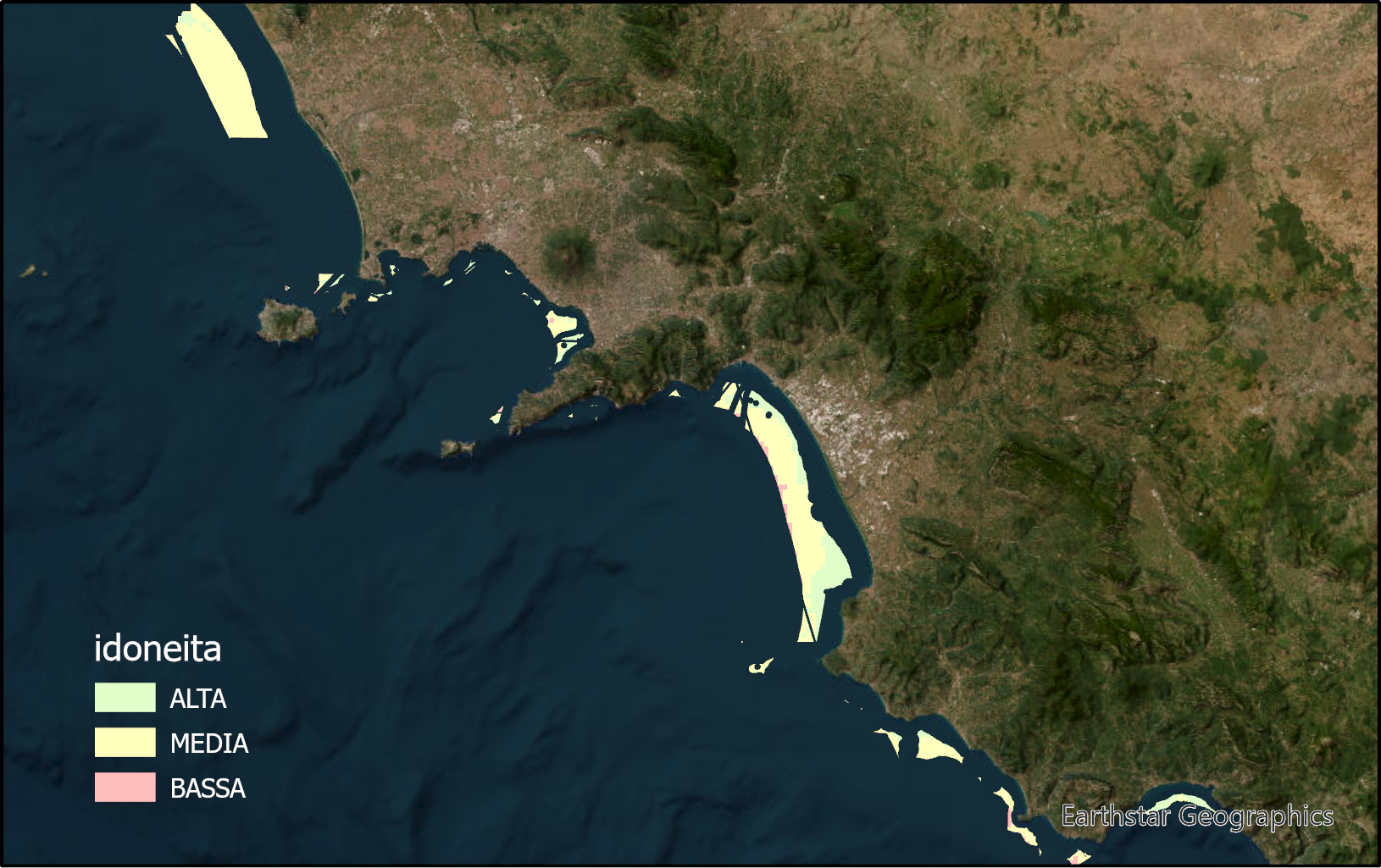
Suitable marine zones for marine fish culture in territorial waters of Campania region
The layer identifies marine zones highly suitable for sea bass and sea breams aquaculture in the Campania region. These zones are between the bathymetric of 25 and 80m. Zones under environmental constraints and for other marine uses are excluded.
Simple
- Date ( Publication )
- 2023-09-12
- Credit
- ISPRA Italian Institute for Environmental Protection and Research– BIO-AMC Area manager: Giovanna Marino. Contributors: Maria Paola Campolunghi, Tommaso Petochi, Francesco Cardia, Gianfranco Calise, Matteo Ciani.
- Status
- Completed
- Maintenance and update frequency
- Not planned
- Keywords
-
- feamp
- campania
- aquaculture
- Fishfarming
- Allocated Zones for Aquaculture (AZA)
- GEMET - INSPIRE themes, version 1.0 GEMET - INSPIRE themes, version 1.0 ( Theme )
-
- Agricultural and aquaculture facilities
- Use limitation
- None
- Use constraints
- Other restrictions
- Other constraints
- Data policy of the project (link)
- Access constraints
- Other restrictions
- Other constraints
- Data policy of the project (link)
- Classification
- Unclassified
- Spatial representation type
- Vector
- Metadata language
- it
- Character set
- UTF8
- Topic category
-
- Biota
- Oceans
- Planning cadastre
N
S
E
W
))
- Supplemental Information
- Any other descriptive information about the dataset
- Reference system identifier
- ETRS 1989 UTM Zone 33N
Spatial representation info
No information provided.
- Topology level
- Geometry only
- Geometric object type
- Surface
- Geometric object count
- 1
- Distribution format
-
-
shapefile
(
1.0
)
-
shapefile
(
1.0
)
- OnLine resource
- aza ( WWW:LINK-1.0-http--link )
- Hierarchy level
- Model
- Dataset
- x
Conformance result
- Date ( Publication )
- 2020-08-04
- Explanation
- Validated in Geonetwork according to the ISO19115 rules (25/25) and the INSPIRE rules (30/30)
- Pass
- Yes
- Statement
- The layer was obtained through the weighted linear combination of raster format-expressed criteria defining the suitability of a marine area to host sea bass and sea bream farming facility. These oceanographic, physical, geo-biochemical, and socioeconomic criteria were resampled through computational models to a spatial resolution of 750m and reclassified on a 1-10 scale indicating 10 as optimal and 1 as critical. The weighted sum produced a raster information layer expressed by suitability indices on a 1-10 scale.
- File identifier
- facf055d-5da3-4d8f-a529-f20268bda118 XML
- Metadata language
- en
- Character set
- UTF8
- Hierarchy level
- Dataset
- Date stamp
- 2023-09-12T10:25:05
- Metadata standard name
- ISO 19115:2003/19139
- Metadata standard version
- 1.0
Overviews

Spatial extent
N
S
E
W
))
Provided by

Associated resources
Not available
 FEAMP GeoNetwork catalogue