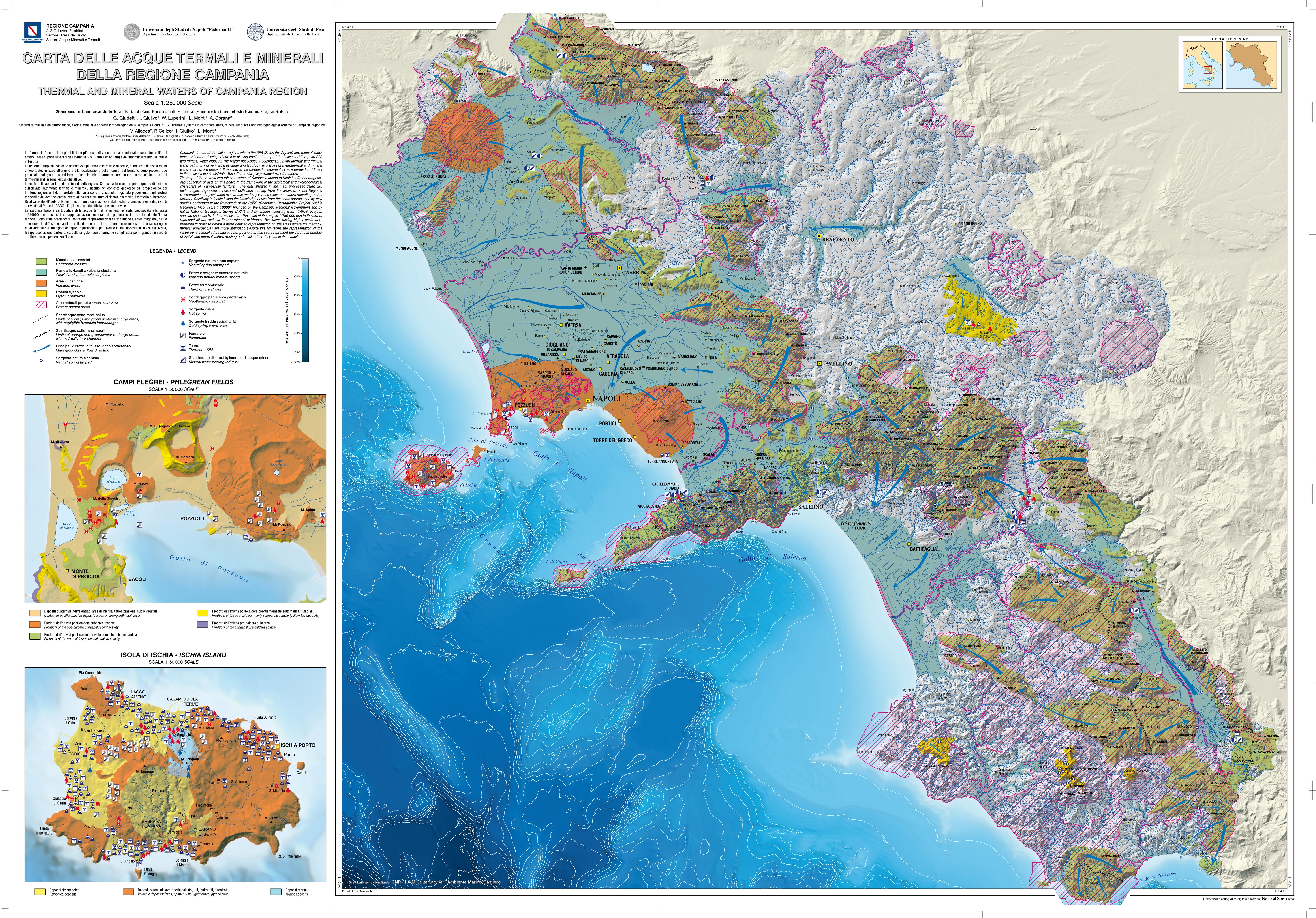
Carta delle acque minerali e termali della Regione Campania
This cartography provides a first overview on a scale of 1: 250,000, of the thermal and mineral heritage of Campania inserted in the geological and hydrogeological context of the area. The data reported on the map derive from a collection of hydrogeological, geochemical and geo-structural information from regional archives, scientific works and specific studies carried out in the context of geological sheets (CARG Project).
Simple
- Date ( Creation )
- 2020-07-28
- Presentation form
- Digital map
- Credit
- © Campania Region
- Status
- On going
- Maintenance and update frequency
- As needed
- Keywords
-
- feamp
- campania
- chart
- morphology
- geology
- geosito
- thermal water
- GEMET - INSPIRE themes, version 1.0 GEMET - INSPIRE themes, version 1.0 ( Theme )
-
- Geology
- Use limitation
- none
- Access constraints
- Other restrictions
- Other constraints
- Data policy of the project (link)
Resource constraints
No information provided.
- Use constraints
- Other restrictions
- Other constraints
- Data policy of the project (link)
- Classification
- Restricted
- Metadata language
- it
- Topic category
-
- Geoscientific information
- Description
- x
N
S
E
W
))
- Supplemental Information
- https://sit2.regione.campania.it/content/geologia-geotematismi-itinerari-geologico-ambientali
- Distribution format
-
-
JPG
(
.jpg
)
-
JPG
(
.jpg
)
- Hierarchy level
- Non geographic dataset
- Other
- Carta
Conformance result
- Date ( Revision )
- 2020-08-20
- Explanation
- Validated in Geonetwork according to the ISO19115 rules (25/25) and the INSPIRE rules (31/31)
- Pass
- Yes
- Statement
- Mariacristina Prampolini (CNR-ISMAR) downloaded the chart and digitized (ArcGIS 10.2) the geosites in a buffer of 10 km from the coast
- File identifier
- 4d34d446-7016-41a8-941e-d044dedfacee XML
- Metadata language
- en
- Character set
- UTF8
- Parent identifier
- Active fluid vents - Gulf of Pozzuoli e5d9ff87-751f-4445-a7c5-af0c6ec7dcaf
- Hierarchy level
- Dataset
- Date stamp
- 2020-08-24T15:47:10
- Metadata standard name
- ISO 19115:2003/19139
- Metadata standard version
- 1.0
Overviews

Spatial extent
N
S
E
W
))
Provided by

Associated resources
Not available
 FEAMP GeoNetwork catalogue