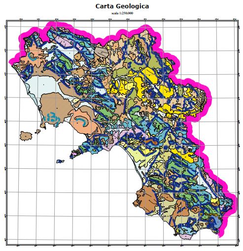
Geologic chart
The geological map was produced by APAT, the Agency for the Protection of the Environment and for Technical Services, as a summary of the surveys carried out on a national scale as part of the CARG Project, National Geological Cartography, at a scale of 1: 50,000. Some changes were necessary for the volcanic themes of the Neapolitan area.
Simple
- Date ( Creation )
- 2020-10-07
- Presentation form
- Digital map
- Credit
- © APAT
- Status
- Completed
- Maintenance and update frequency
- Not planned
- Keywords
-
- feamp
- campania
- chart
- geology
- GEMET - INSPIRE themes, version 1.0 GEMET - INSPIRE themes, version 1.0 ( Theme )
-
- Geology
- Use limitation
- none
- Access constraints
- Other restrictions
- Other constraints
- Data policy of the project (link)
Resource constraints
No information provided.
- Use constraints
- Other restrictions
- Other constraints
- Data policy of the project (link)
- Classification
- Restricted
- Metadata language
- it
- Topic category
-
- Environment
- Description
- x
N
S
E
W
))
- Supplemental Information
- http://www.difesa.suolo.regione.campania.it/content/category/6/46/71/
- Distribution format
-
-
PDF
(
.pdf
)
-
PDF
(
.pdf
)
- Hierarchy level
- Non geographic dataset
- Other
- Carta
Conformance result
- Date ( Revision )
- 2020-10-07
- Explanation
- Validated in Geonetwork according to the ISO19115 rules (25/25) and the INSPIRE rules (31/31)
- Pass
- Yes
- Statement
- Mariacristina Prampolini (CNR) donwloaded the chart on 07/10/2020 from http://www.difesa.suolo.regione.campania.it/content/category/6/46/71/
- File identifier
- 80d2784b-e510-45b8-b710-4eaa12c274d7 XML
- Metadata language
- en
- Character set
- UTF8
- Parent identifier
- Active fluid vents - Gulf of Pozzuoli e5d9ff87-751f-4445-a7c5-af0c6ec7dcaf
- Hierarchy level
- Dataset
- Date stamp
- 2020-10-08T14:54:11
- Metadata standard name
- ISO 19115:2003/19139
- Metadata standard version
- 1.0
Overviews

Spatial extent
N
S
E
W
))
Provided by

Associated resources
Not available
 FEAMP GeoNetwork catalogue