 FEAMP GeoNetwork catalogue
Formato di distribuzione della risorsa (es. Shapefile)
Type of resources
Topics
INSPIRE themes
Provided by
Formats
Representation types
Update frequencies
status
-
Physical parameters collected during the ABBACO oceanographic campaign, in the Bagnoli Bay during July 2018 and in February, March, May, July, September and October 2019. The sampling parameters are temperature (°C), conductivity, oxygen (% sat; ml/l), transmittance (%), Ph, fluorescence (RFU), turbidity, salinity and density. The parameters are collected over the entire water column.
-
Brief narrative summary of the content of the resource(s)
-
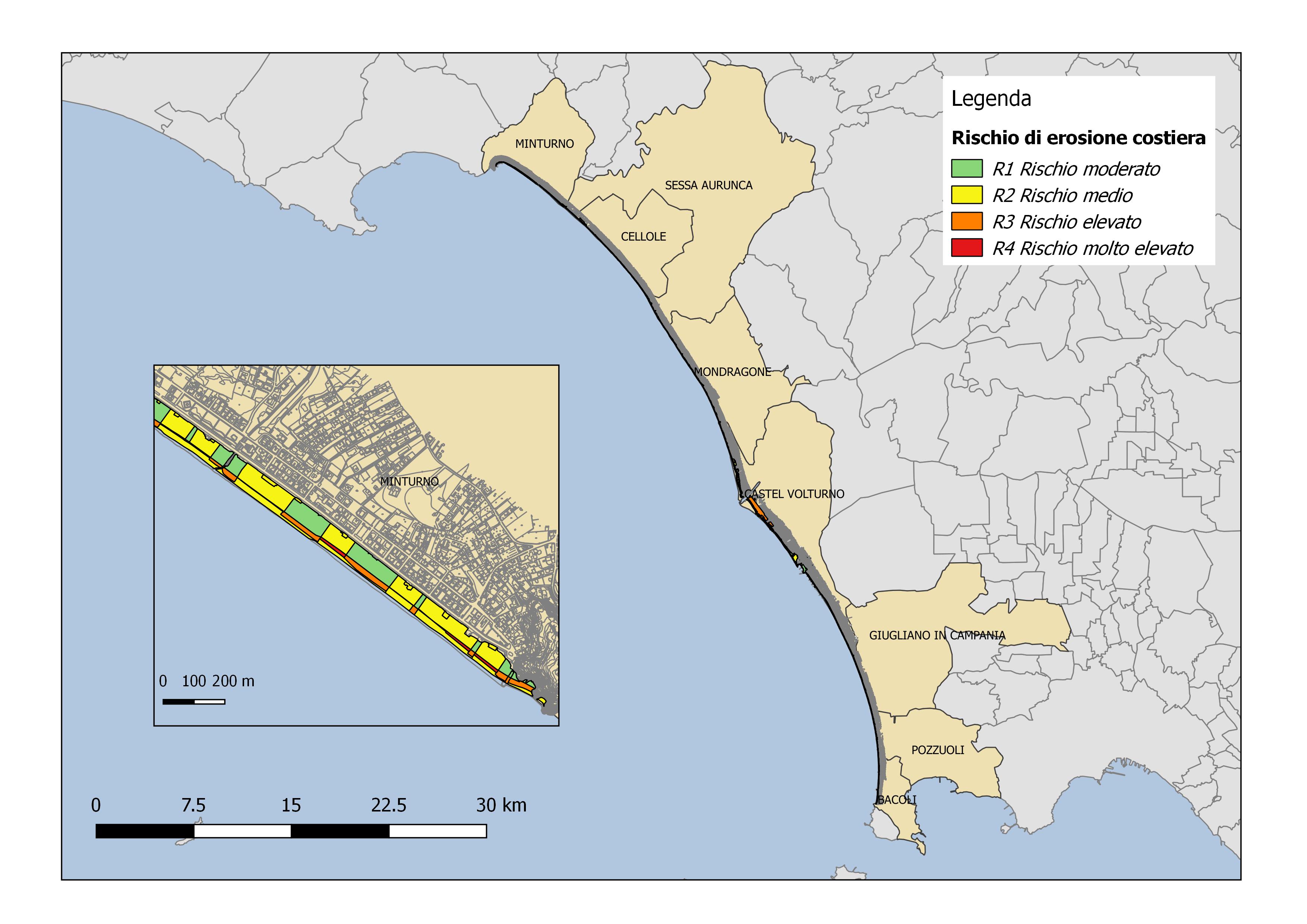
Coastal erosion risk maps for the Campania Region derived from Piano Stralcio Erosione Costiera (PSEC), Autorità di Bacino Distrettuale dell'Appennino Meridionale
-

Scombridae (Euthynnus alletteratus, Sarda sarda, Auxis thazard) fishing areas obtained from logbook data and interview
-
Brief narrative summary of the content of the resource(s)
-

Participatory mapping of small-scale fishing. Small-scale fishing effort is provided in the form of polygons, drawn by fishermen during the interviews on the standardized grid for the cartographic mapping of the answers, and later digitalized. The dataset contains information about the fishing effort in terms of fishing days (per month and per year), related gear, and targeted species.
-
Brief narrative summary of the content of the resource(s)
-
Brief narrative summary of the content of the resource(s)