Species distribution
Type of resources
Available actions
Topics
INSPIRE themes
Keywords
Contact for the resource
Provided by
Years
Formats
Representation types
Update frequencies
status
-

Potential distribution of Hippocampus hippocampus in the FEAMP area. We used an ecological modelling approach by using Biomod2 package in R. Spatial resolution 1 km2. For further details see: https://onlinelibrary.wiley.com/doi/full/10.1111/ddi.12741
-
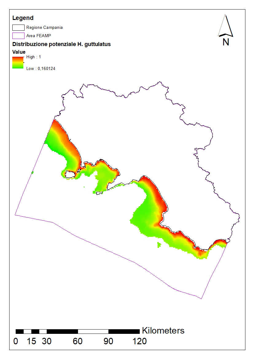
Potential distribution of Hippocampus guttulatus in the FEAMP area. We used an ecological modelling approach by using Biomod2 package in R. Spatial resolution 1 km2. For further details see: https://onlinelibrary.wiley.com/doi/full/10.1111/ddi.12741
-
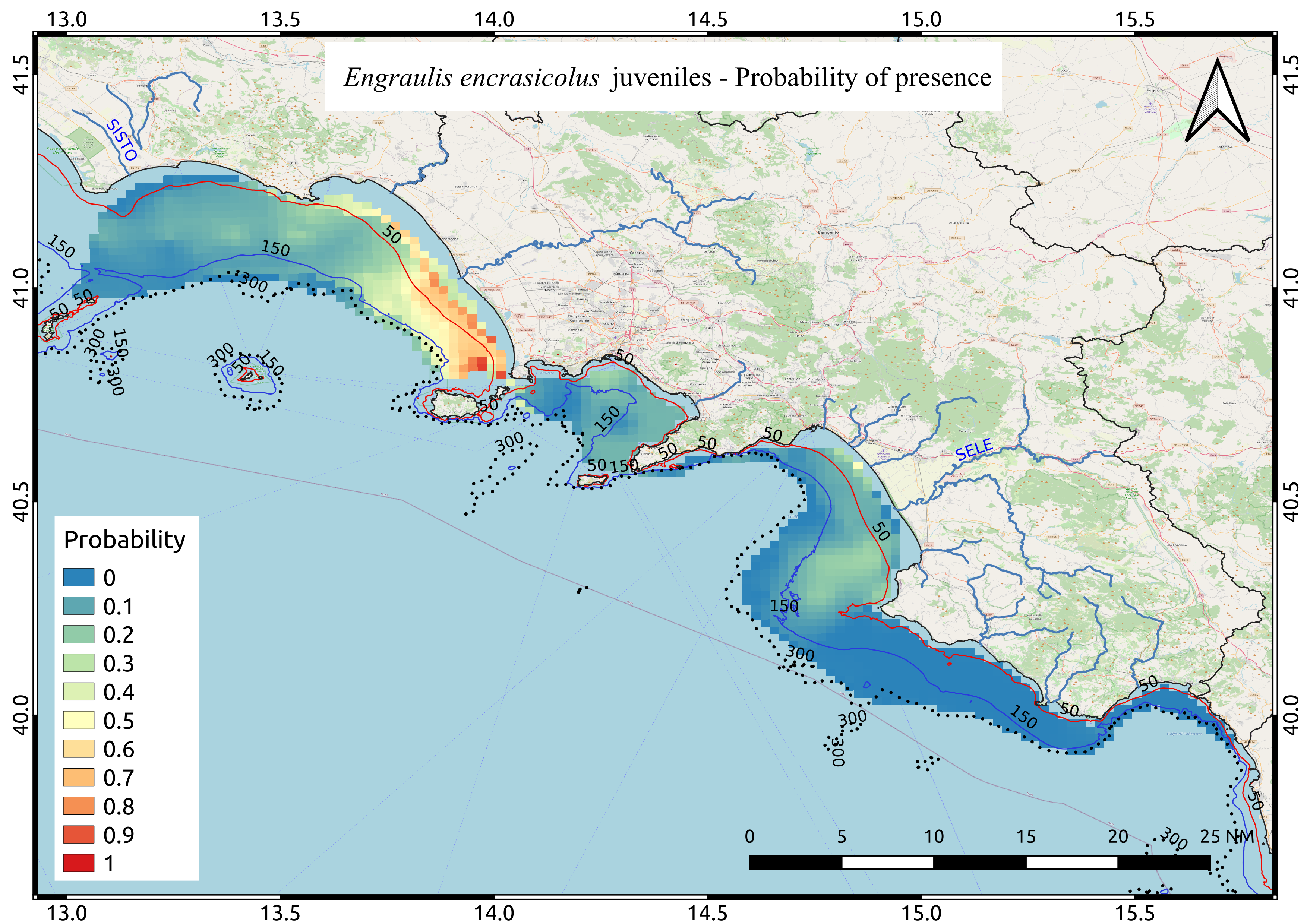
Average probability map of Engraulis encrasicolus juveniles computed by means of Indicator kriging based on 9 years of acoustic surveys carried out in the summer period
-
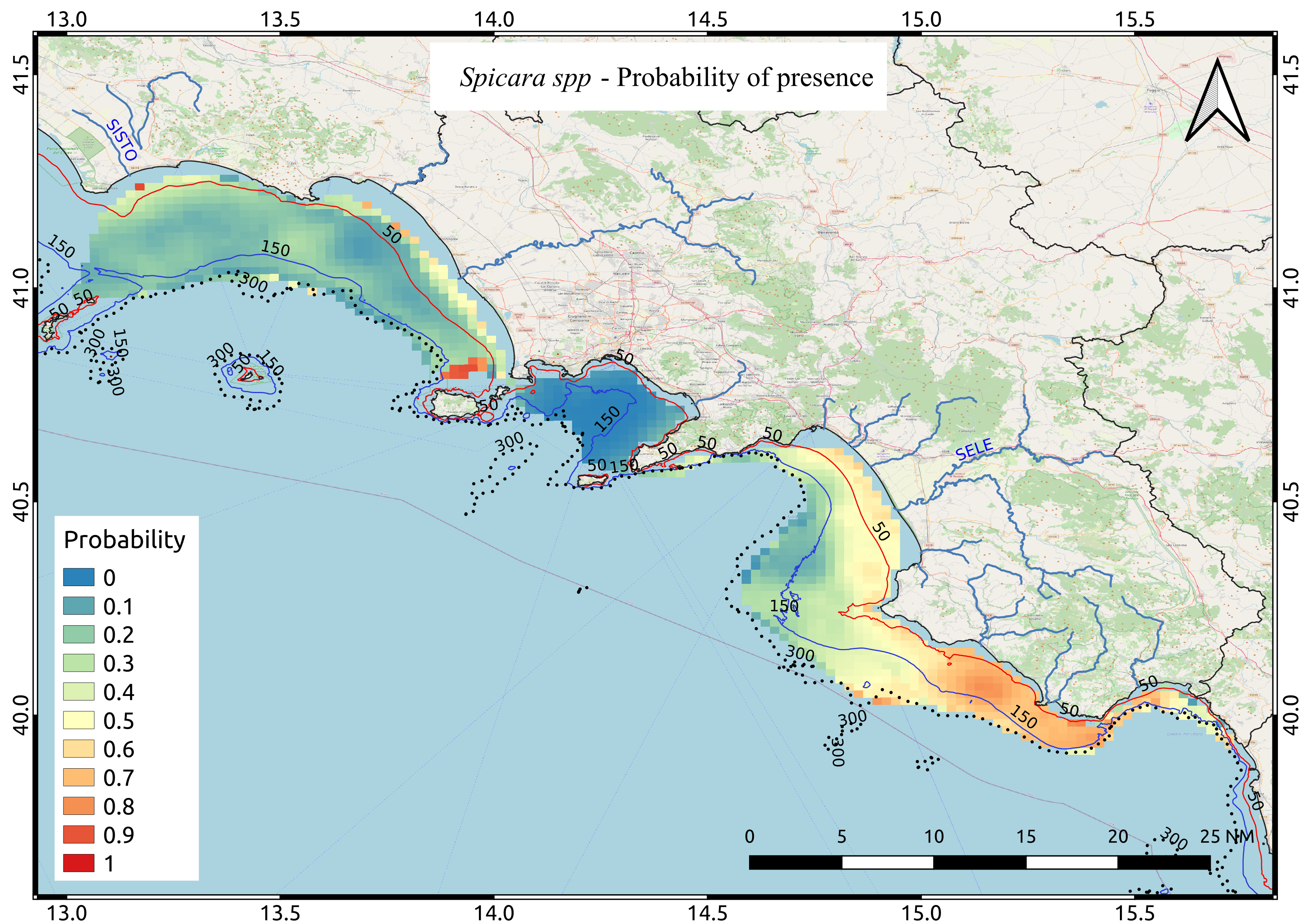
Average probability map of Spicara spp computed by means of Indicator kriging based on 9 years of acoustic surveys carried out in the summer period
-
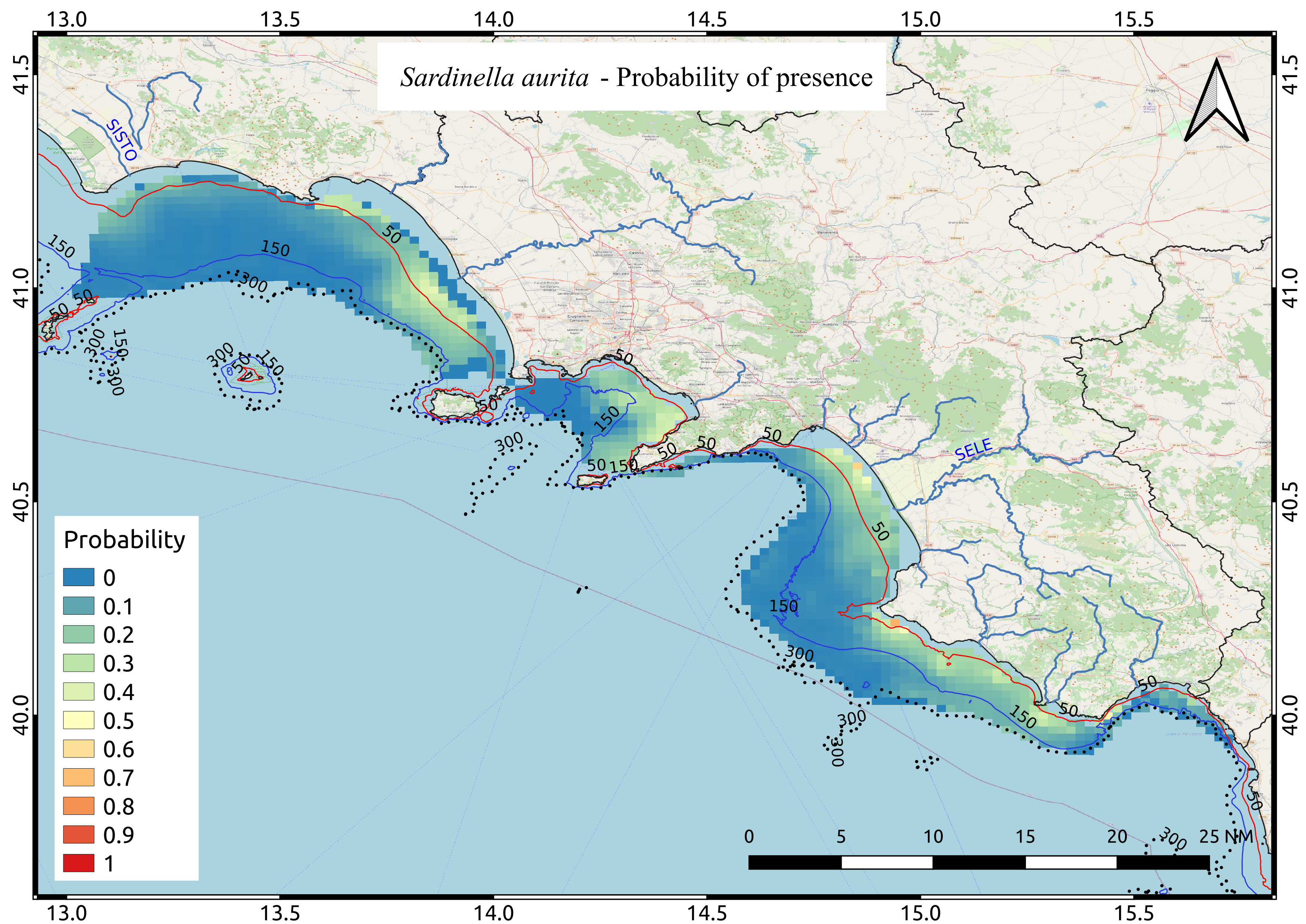
Average probability map of Sardinella aurita computed by means of Indicator kriging based on 9 years of acoustic surveys carried out in the summer period.
-

Average probability map of Boops boops computed by means of Indicator kriging based on 9 years of acoustic surveys carried out in the summer period
-
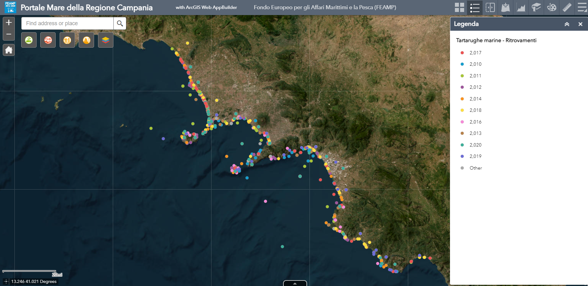
Map showing the distribution of marine turtle strandings (dead and alive) in the Campania Region between 2010 and 2020.
-
Relative abundance of the main bacterial phyla and genera found in the sediments and the hydrothermal fluids of the sampled sites.
-
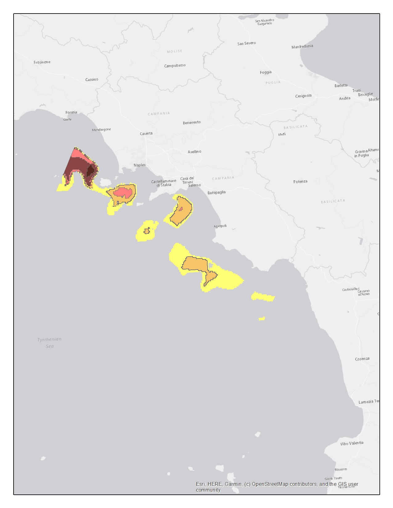
The dataset contains the Essential Fish Habitat (EFH) of 10 marine species along the coast of the Campania region. The dataset is constituted by georeferenced data on the spawning areas and the recruitment areas (nurseries) of these species, in .shp format. The data have been collected in the context of the MEDISEH project (https://imbriw.hcmr.gr/mediseh/). The procedures behind the sampling campaign and other details on the way the whole dataset was built up, are discussed in the “MEDISEH final report” attached. The MEDISEH project was conducted at Mediterranean scale. The entire dataset was handled using ArcGis according to the FEAMP objective and hence restricted to the Campania region. The present dataset includes the EFH for the following demersal and small pelagic species: Eledone cirrosa, Galeus melastomus, Illex coindetii, Merluccius merluccius, Mullus barbatus, Nephrops Norvegicus, Pagellus erhytinus, Parapenaeus longirostris, Trachurus mediterraneous, Trachurus trachurus. For each species, spatial information on the spawning areas or the recruitment areas or both are provided. The files are organized in folders, called by the shortened name of the species and the letter “c” referred to “Campania”. Each of them contains then the folder holding the shapefile, called “Recruitment” or “Spawning” or both, according to the presence/absence of spawning and nursery areas in the Campania region for each species. The shapefiles are collocated and named following the scheme: “species_c_r” for recruitment areas and “species_c_s” for the spawning areas. Ex. the “eledcir_c_r.shp” file refers to the recruitment areas of Eledone cirrosa in Campania. Spatial analysis techniques allow to identify locations that are more likely to be density hot spot areas for fish nurseries and spawning grounds. All the shapefiles are characterized by areas with increasing probability to be an EFH. For the most of the considered species, the areas of interest are featured by 5 levels of probability (0.5-20%, 20-40%, 40-60%, 60-80%, 80-100%). In the cases of Trachurus mediterraneous and Trachurus trachurus the areas are instead featured by 3 levels of probability (25-50%, 50-75%, 75-100%) both for nurseries and spawning locations.
-

Average probability map of Trachurus tracurus computed by means of Indicator kriging based on 9 years of acoustic surveys carried out in the summer period
 FEAMP GeoNetwork catalogue