notPlanned
Type of resources
Available actions
Topics
INSPIRE themes
Keywords
Contact for the resource
Provided by
Years
Formats
Representation types
Update frequencies
status
-
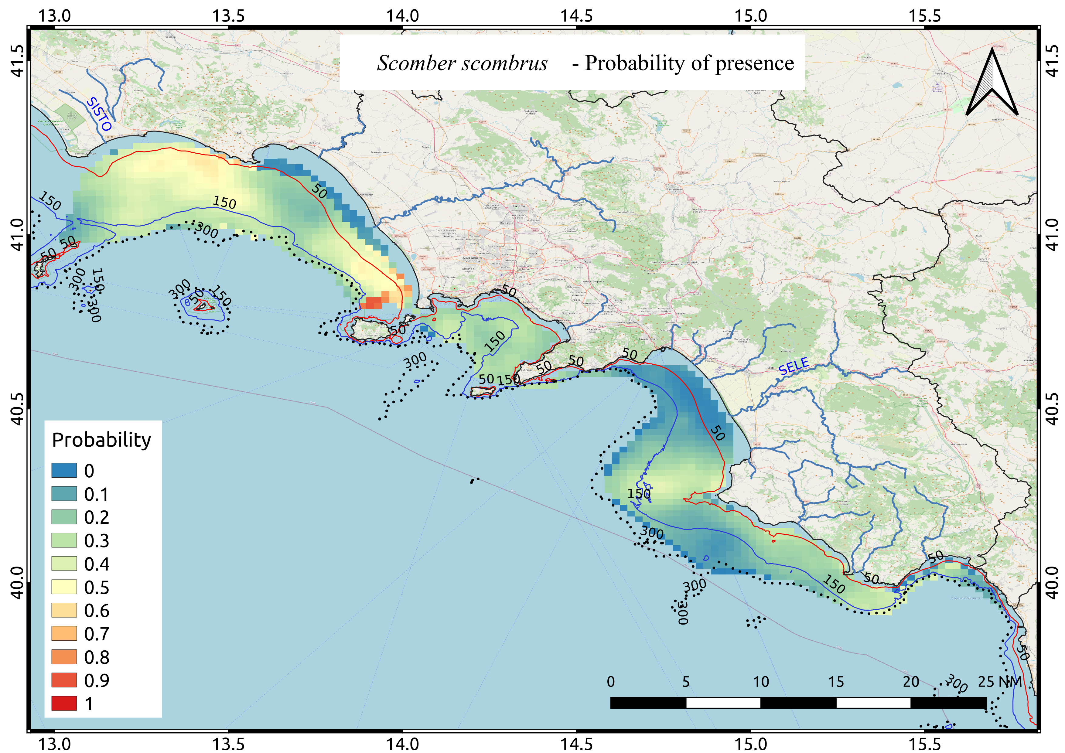
Average probability map of Scomber scombrus computed by means of Indicator kriging based on 9 years of acoustic surveys carried out in the summer period
-
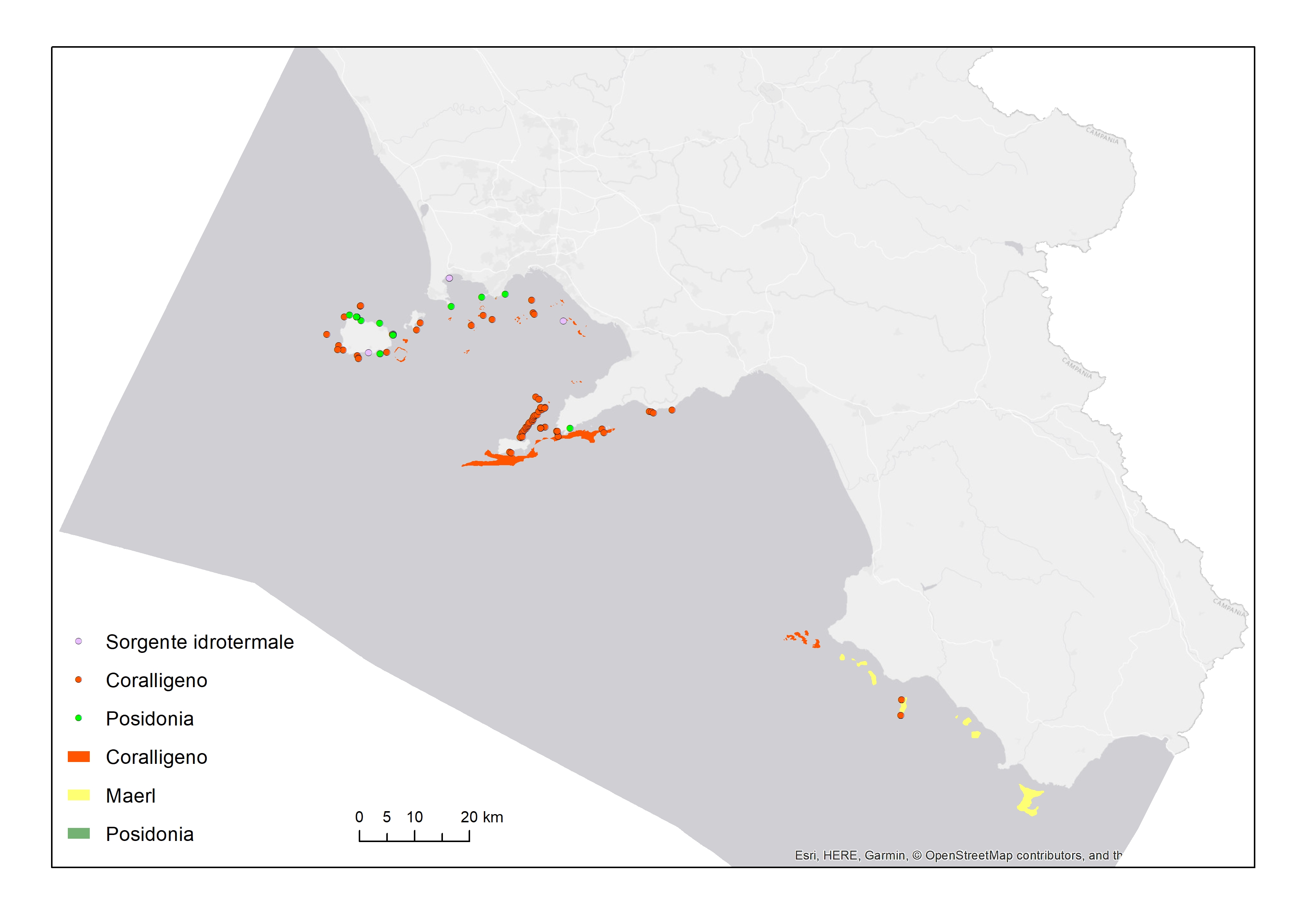
Habitat extent and observations from bibliography
-

Average probability map of Boops boops computed by means of Indicator kriging based on 9 years of acoustic surveys carried out in the summer period
-
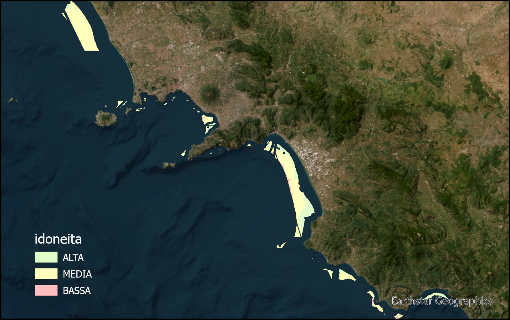
The layer identifies marine zones highly suitable for sea bass and sea breams aquaculture in the Campania region. These zones are between the bathymetric of 25 and 80m. Zones under environmental constraints and for other marine uses are excluded.
-

The layer identifies marine zones highly suitable for shellfish aquaculture in the Campania region. These zones are between the bathymetric of 25 and 80m. Zones under environmental constraints and for other marine uses are excluded.
-
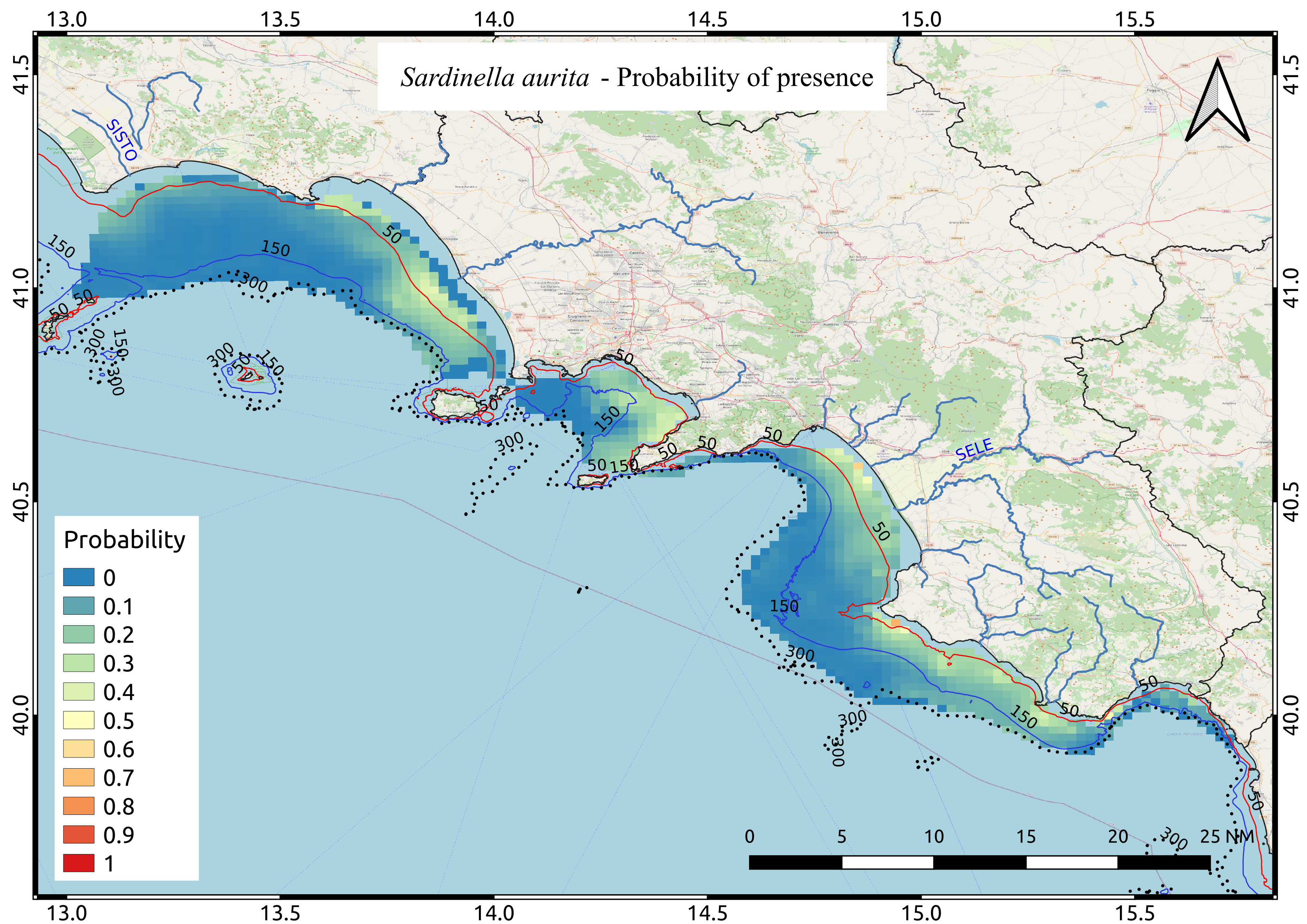
Average probability map of Sardinella aurita computed by means of Indicator kriging based on 9 years of acoustic surveys carried out in the summer period.
-

The layer identifies marine zones highly suitable for tuna aquaculture in the Campania region. These zones are between the bathymetric of 25 and 80m. Zones under environmental constraints and for other marine uses are excluded.
-

Average probability map of Trachurus tracurus computed by means of Indicator kriging based on 9 years of acoustic surveys carried out in the summer period
-
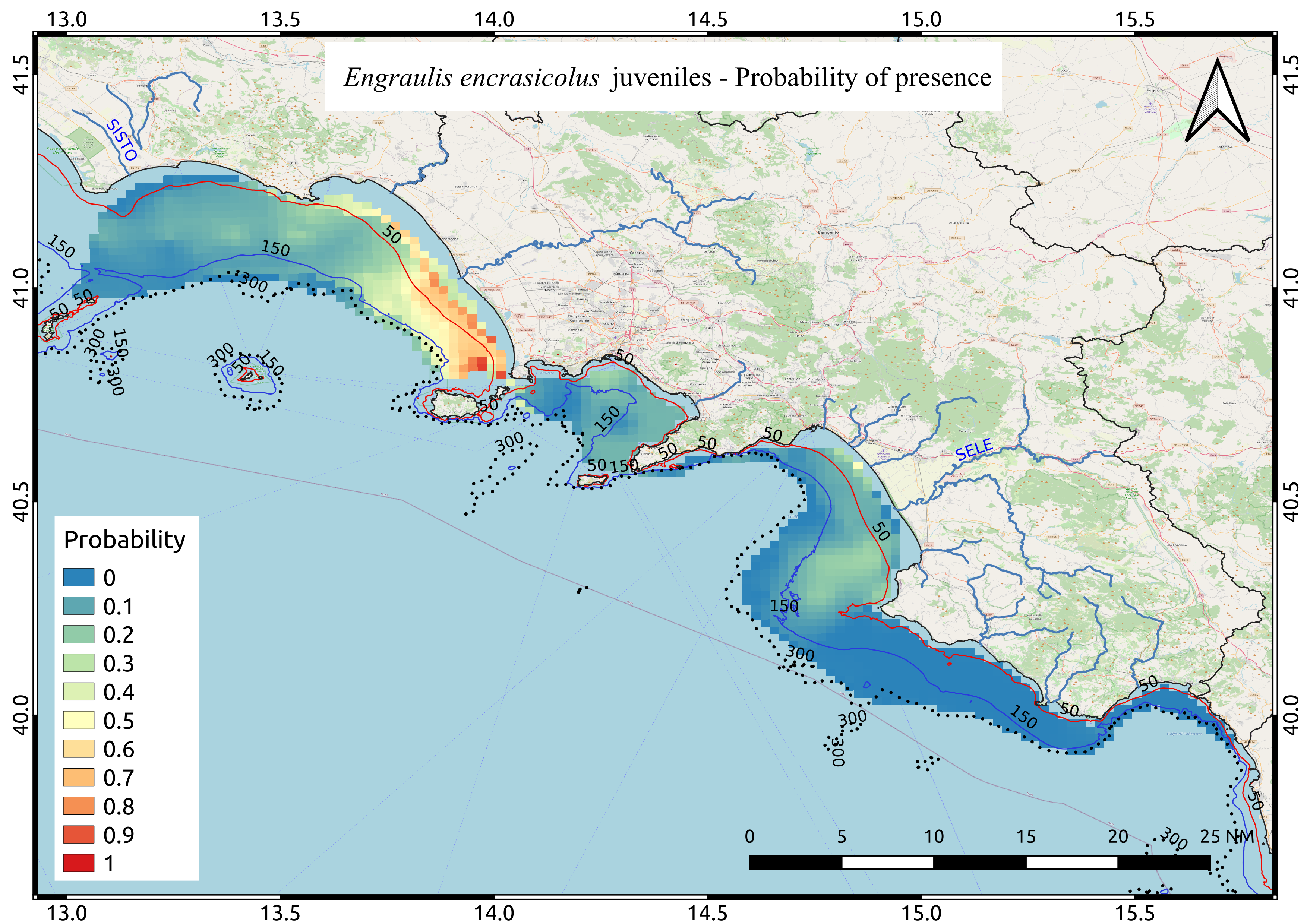
Average probability map of Engraulis encrasicolus juveniles computed by means of Indicator kriging based on 9 years of acoustic surveys carried out in the summer period
-

Average probability map of Engraulis encrasicolus computed by means of Indicator kriging based on 9 years of acoustic surveys carried out in the summer period
 FEAMP GeoNetwork catalogue