feamp
Type of resources
Available actions
Topics
INSPIRE themes
Keywords
Contact for the resource
Provided by
Years
Formats
Representation types
Update frequencies
status
Scale
Resolution
-

Fisheries restricted areas carried out with towed gear according to article 11 clause 2 of Reg. (UE) n° 1022/2019.
-
Brief narrative summary of the content of the resource(s)
-
Brief narrative summary of the content of the resource(s)
-
Chemical data
-

Potential distribution of Hippocampus hippocampus in the FEAMP area. We used an ecological modelling approach by using Biomod2 package in R. Spatial resolution 1 km2. For further details see: https://onlinelibrary.wiley.com/doi/full/10.1111/ddi.12741
-
Pictures of photo quadrats at three different depth of selected sampling sites within MPA Regno di Nettuno
-
Brief narrative summary of the content of the resource(s)
-

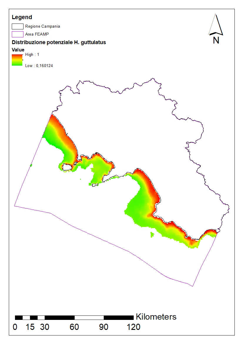
Potential distribution of Hippocampus guttulatus in the FEAMP area. We used an ecological modelling approach by using Biomod2 package in R. Spatial resolution 1 km2. For further details see: https://onlinelibrary.wiley.com/doi/full/10.1111/ddi.12741
-
Brief narrative summary of the content of the resource(s)
-

Brief narrative summary of the content of the resource(s)
 FEAMP GeoNetwork catalogue