Environment
Type of resources
Available actions
Topics
INSPIRE themes
Keywords
Contact for the resource
Provided by
Years
Formats
Representation types
Update frequencies
status
Resolution
-
Chemical data
-
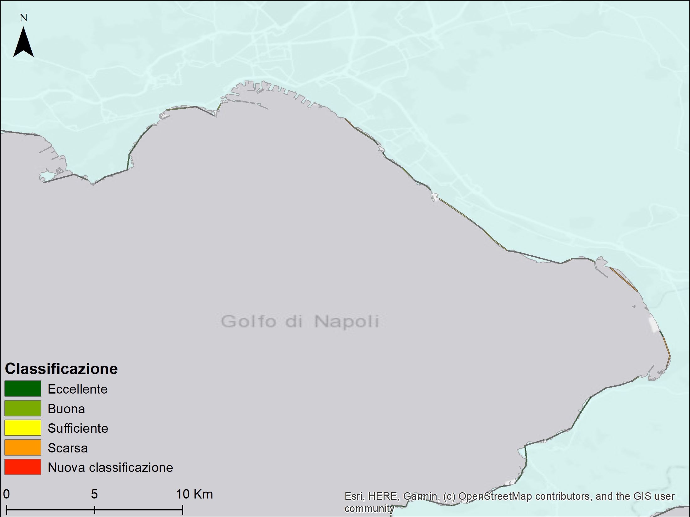
Campania bathing water classification as reported in 2020 by ARPA Campania. The suitability judgment stems from the statistical analysis of the last four years of monitoring activities about the presence of two bacteriological parameters: Escherichia coli and Enterococcus spp. that are considered specific indicators of fecal contamination according to WHO.
-
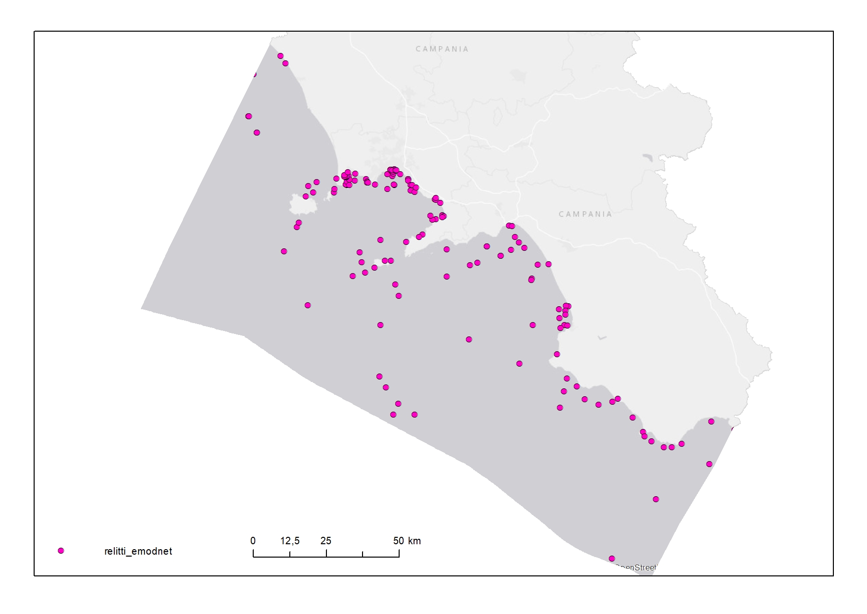
Wrecks in the Territorial Sea (12 NM) of Campania Region
-
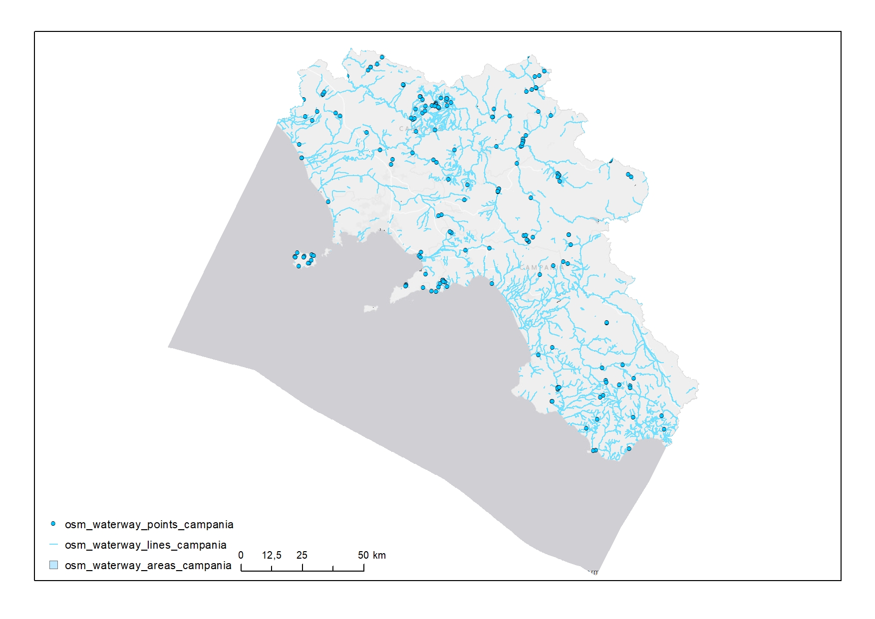
Waterways in Campania
-

Geologic map of Ischia - Scale 1:10.000 - Sheet 464
-

The bottom oxygen concentration (bottomO2) map package was built with monthly-mean data remotely collected. The package contains mean, max, min bottomO2 maps at low resolution (~5km) collected during 2019. The maps were also built over the four quarters of the year. These layers are provided with the suffixes Q1 to Q4.
-
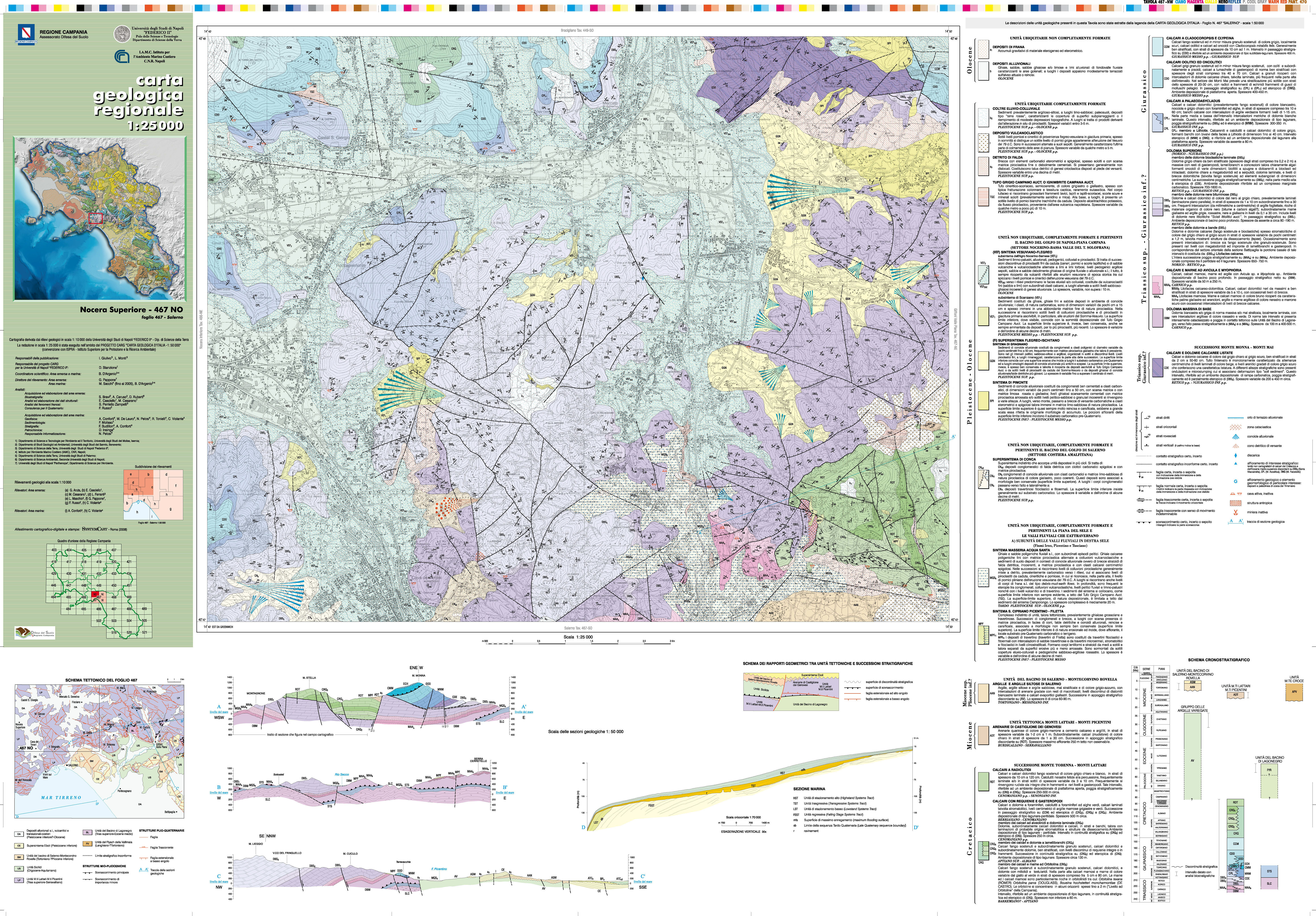
Geologic map of Nocera Superiore - Scale 1:25.000 - Sheet 467 NO
-

The sea surface primary production (PPN) map package was built with daily-mean data remotely collected. The package contains mean, max, min PPN maps at low resolution (~5km) collected during 2020. The maps were also built over the four quarters of the year. These layers are provided with the suffixes Q1 to Q4.
-
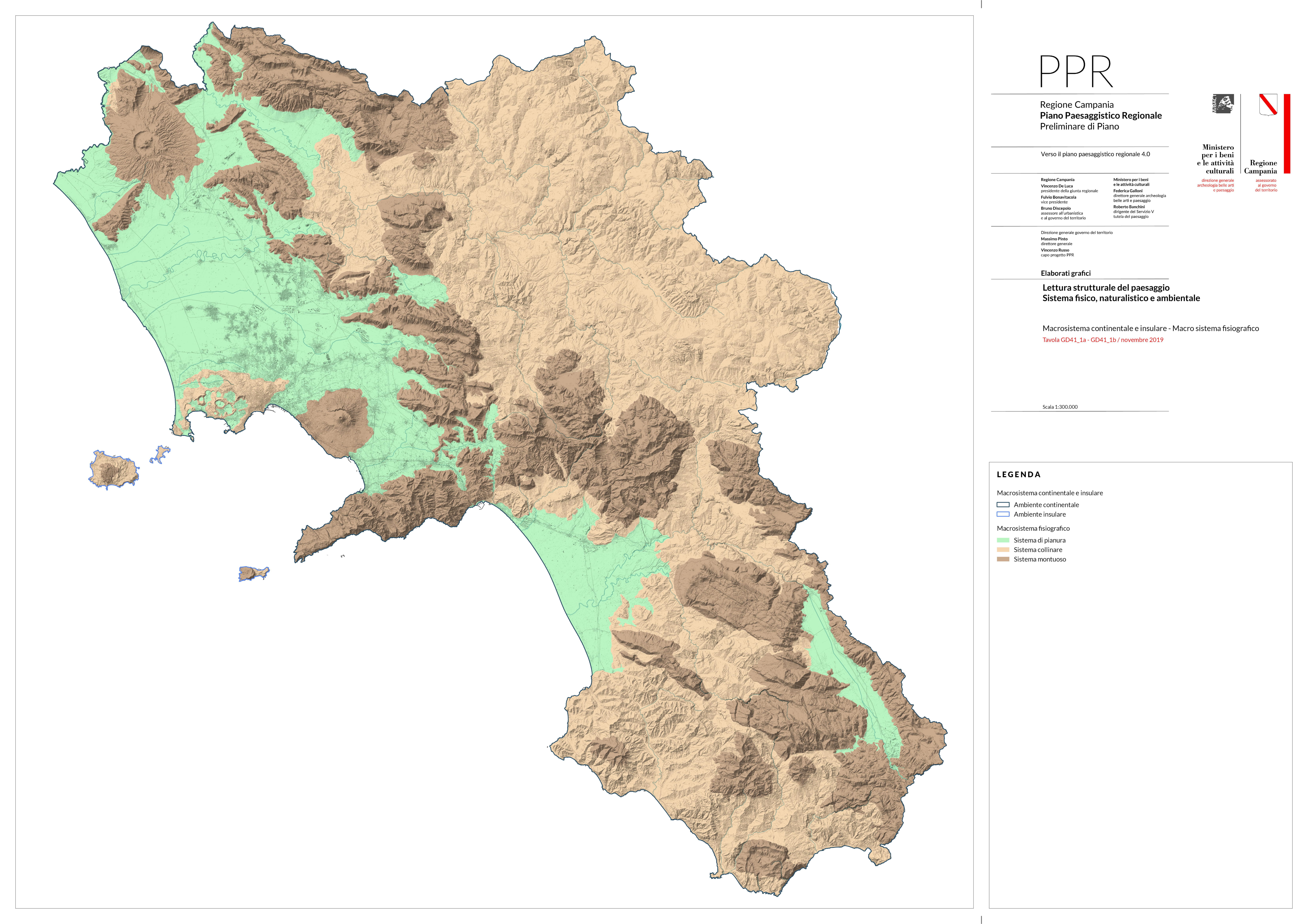
Continental and insular macrosystem map of the Campania Region - Scale 1:300.000
-
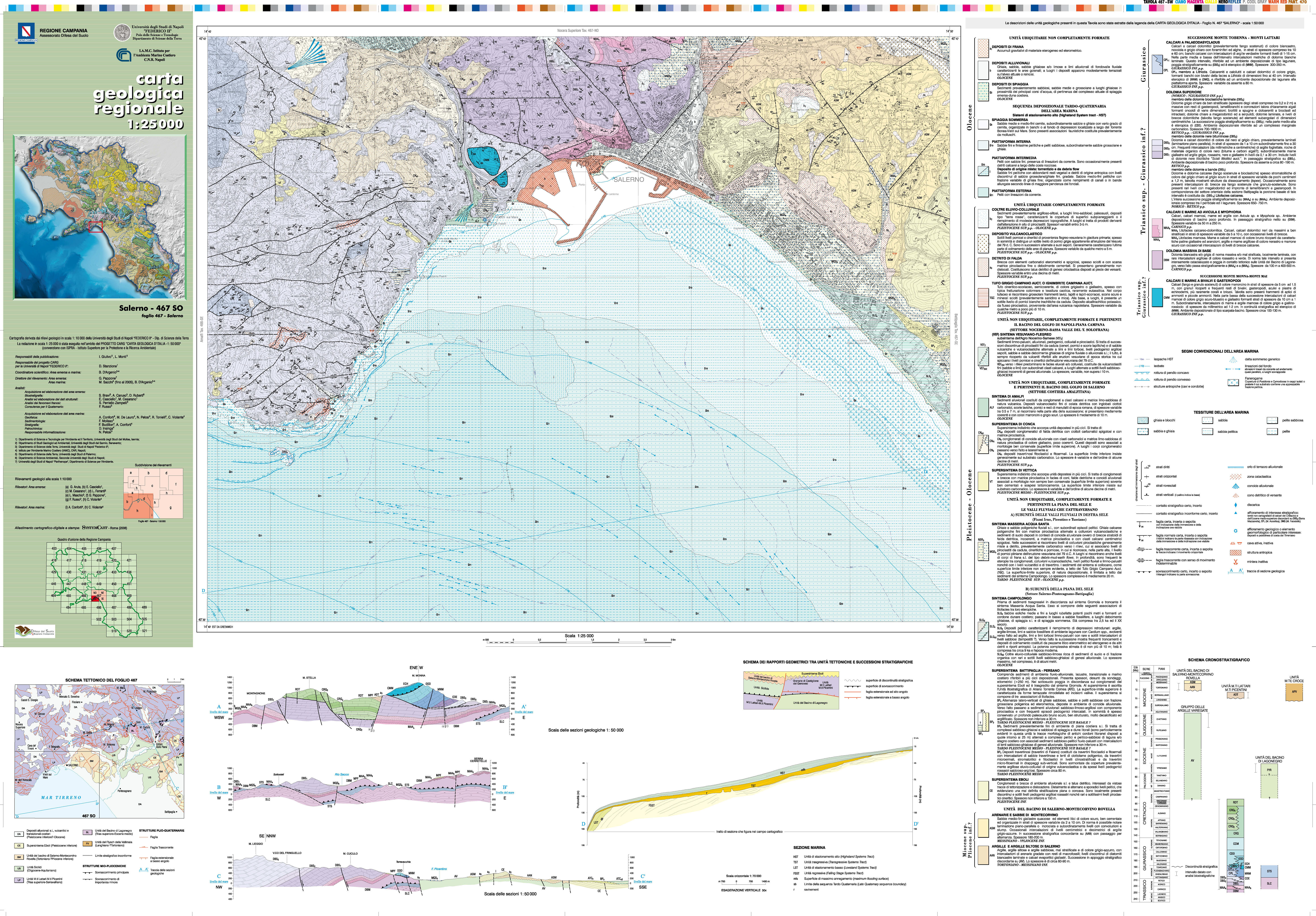
Geologic map of Salerno - Scale 1:25.000 - Sheet 467 SO
 FEAMP GeoNetwork catalogue