geology
Type of resources
Topics
INSPIRE themes
Keywords
Contact for the resource
Provided by
Years
Formats
Representation types
Update frequencies
status
-
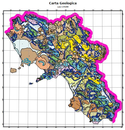
The geological map was produced by APAT, the Agency for the Protection of the Environment and for Technical Services, as a summary of the surveys carried out on a national scale as part of the CARG Project, National Geological Cartography, at a scale of 1: 50,000. Some changes were necessary for the volcanic themes of the Neapolitan area.
-

Complete coastline features for Campania Region with a description of the typology and status
-
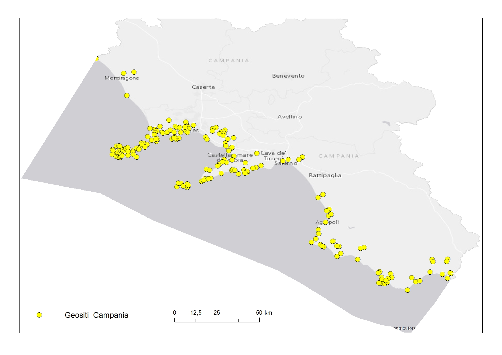
Geosites digitized from "Carta dei Geositi della Campania"
-
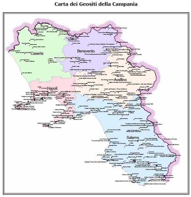
The map of geosites identifies the places where important evidence of the history of the geological evolution of the Campania Region is preserved, and being elements of landscape, scientific and cultural value, they will be suitably inserted in a landscape planning context as points or nodes of the ecological network, which representative aspects of regional geodiversity.
-
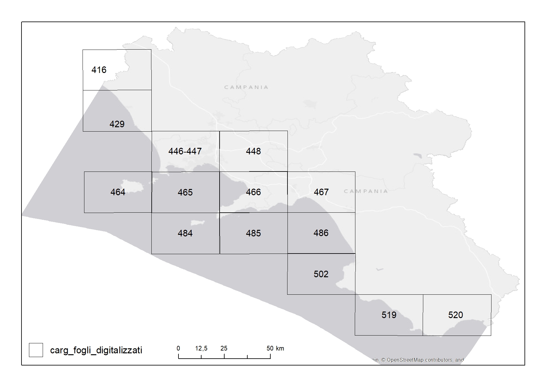
Extent of the geological charts produced in the framework of the CARG project
-
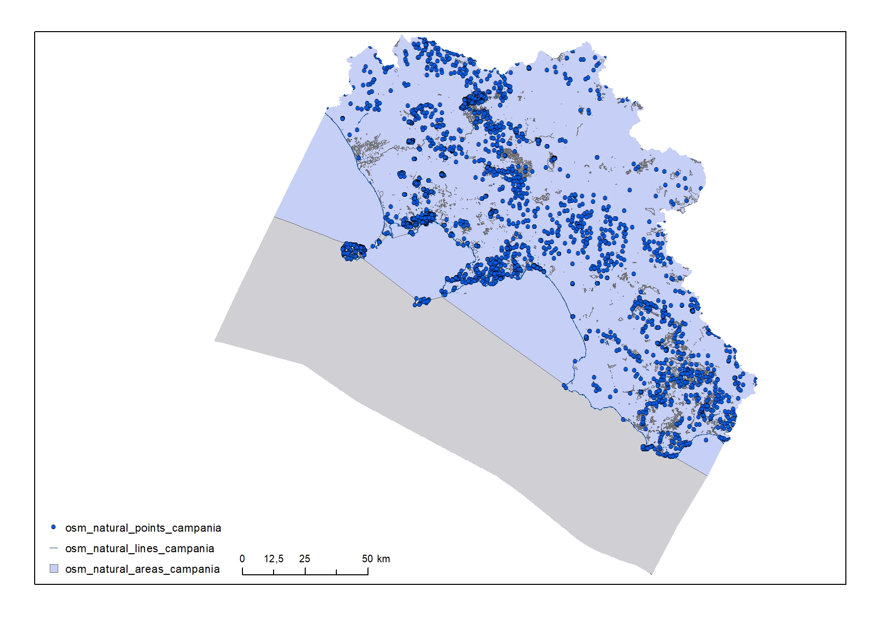
Natural elements in the Campania Region
-
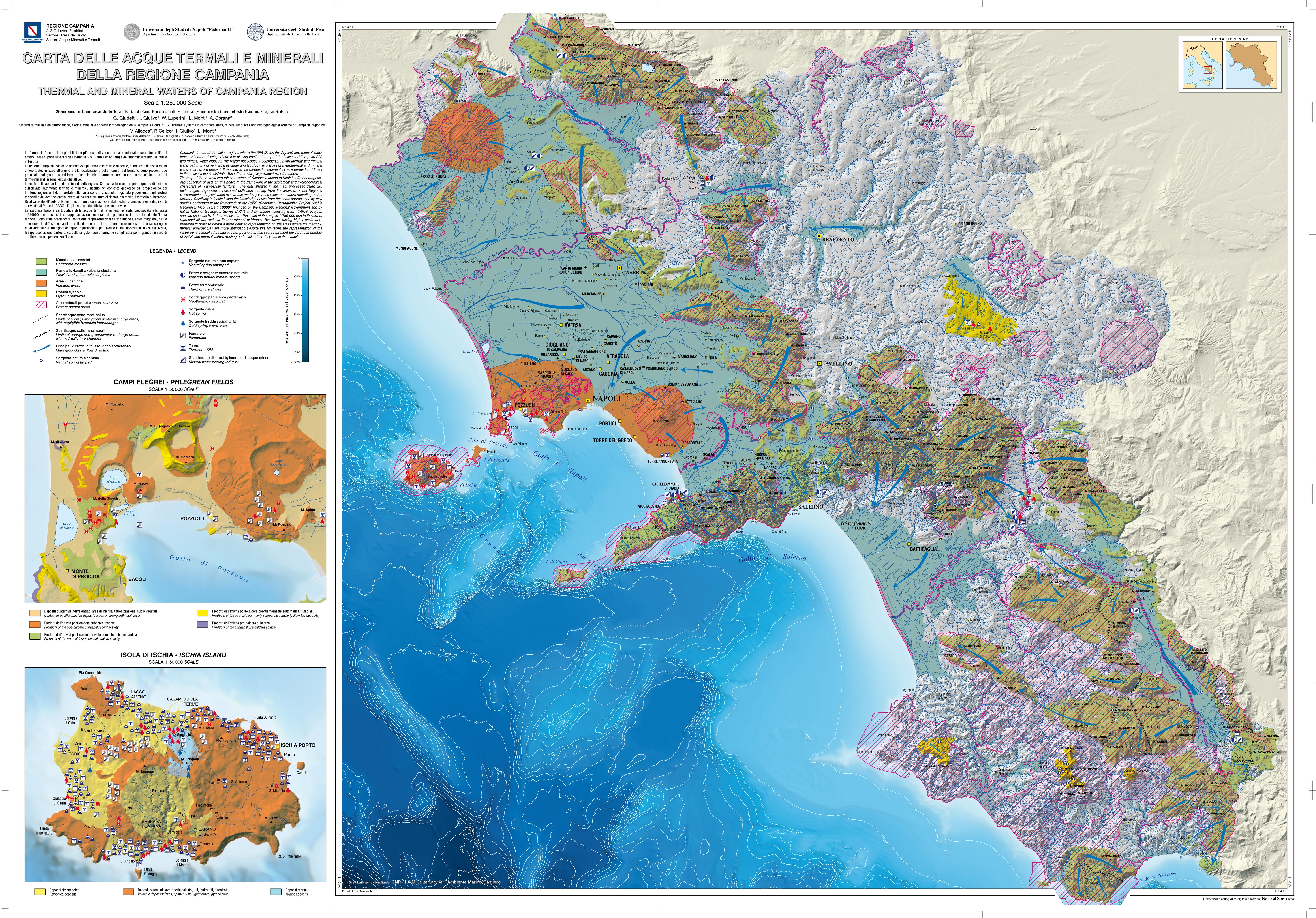
This cartography provides a first overview on a scale of 1: 250,000, of the thermal and mineral heritage of Campania inserted in the geological and hydrogeological context of the area. The data reported on the map derive from a collection of hydrogeological, geochemical and geo-structural information from regional archives, scientific works and specific studies carried out in the context of geological sheets (CARG Project).
-
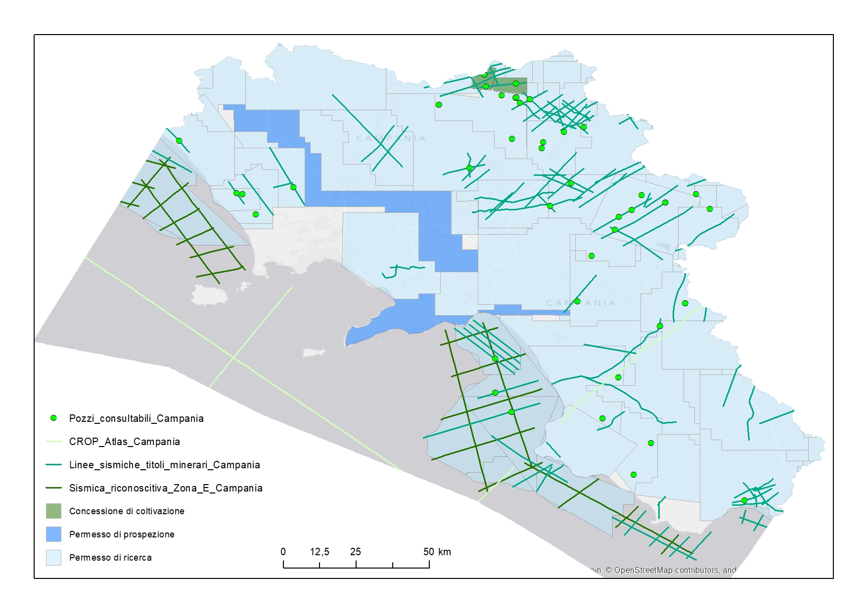
The ViDEPI project has been designed to make all the documents concerning Italian oil exploration easily accessible. The documentation concerns expired, and therefore public, mining permits and concessions, filed since 1957 with UNMIG, National Mining Office for hydrocarbon and geothermal energy of the Ministry for Economic Development.
-

Geosites digitized from "Carta delle acque minerali e termali della Regione Campania"
 FEAMP GeoNetwork catalogue